
What is recorded here
Down castle stands on a sharp esker ridge in County Offaly, its steep mound rising beside a small stream and ancient church. A wide fosse rings the base while a raised bailey extends north, enclosed by earth on three sides. The view reaches far in every direction, suggesting the site was chosen to be seen before it was hidden.
Well preserved motte and bailey located on top of an esker ridge with good views in all directions, with early medieval church (OF026-022-----) nearby and small stream to the W. Flat topped steep sided conical shaped mound (H 7.5m; top diam 11.5m; base diam 46m) with enclosing fosse (Wth 4.6-8m; D 1m) at its base and raised rectangular shaped bailey (47m E-W; 39m N-S; H 1.5m) to the N which is enclosed by an earthen bank at N, E and W.
The above description is derived from the published 'Archaeological Inventory of County Offaly' (Dublin: Stationery Office, 1997). In certain instances the entries have been revised and updated in the light of recent research.
Date of upload: 23 May 2011
The monument record does not grant public access. Check the route and ask the landowner before entering private land.
- What survives
- Recorded monument
Places near here
 Corn MillMill, unclassified · 226 yd
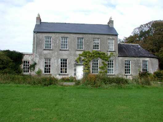 Bloomvillecountry house · 275 yd
 Kilmanoge church (Site of) , GraveyardChurch · 760 yd
 ToberkieranHoly well · 1756 yd
 Raheen Castle (site of)Archaeological place · 1.1 mi
 Raheen Castle in ruinsCastle, unclassified · 1.1 mi
 Geashill Glebe WalkVisitor information · 2.3 mi
 Father BurbageMemorial · 2.3 mi
 Ghaugher HillMountain / peak · 2.5 mi
 Furzehill WoodWood · 2.5 mi
 The Lord's WellSpring · 2.8 mi
 Church (in Ruins), GraveyardChurch · 3.4 mi
Other information
Photo: Credit not shown in the picture search · Rights wording not checked; contact us if this picture should be removed