
What is recorded here
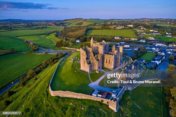
Situated on the top of a natural rise in gently undulating pasture-land, 15m S of the roadway which marks the boundary between Mace and Kilmacahill or Caraun townlands. Possible deserted medieval settlement earthworks (WM006-039----) 140m to N. Franciscan friary (WM006-038----) 370m to NE. A sub-circular shaped area (approx. diam. 40m N-S; 47m E-W) enclosed by a substantial earth and stone bank, best preserved at N, and a slight fosse. The bank, which has several disturbance gaps, appears to have been steepened from NE-S-SSW. Possible entrance gap (Wth 1m) at NW. The interior slopes slightly from NE-SW, and has traces of cultivation ridges which run NNE-SSW. Post-1700 field boundaries intersect the monument at S, SW & NW.
Compiled by: Frank Coyne & Caimin O'Brien
Date of upload: 31 January 2017
The monument record does not grant public access. Check the route and ask the landowner before entering private land.
- What survives
- Recorded monument
Places near here
 Nunnery (in Ruins)Religious house, Franciscan Third Order Regular · 422 yd
 Partially hachuredEnclosure · 1000 yd
 Ballycorkey Bridgebridge · 1138 yd
 Site of CastleCastle, unclassified · 1203 yd
 Ecclesiastical enclosure in RathaspickEcclesiastical enclosure · 1417 yd
 Sweet ChestnutSweet Chestnut · 1.3 mi
 Silver FirSilver Fir · 2.0 mi
 CastleCastle, motte and bailey · 2.1 mi
 Edgeworthstown BypassMemorial · 5.2 mi
 Granard MotteMotte-and-bailey castle remains · 9.9 mi
 1798 Monumentmonument · 9.9 mi
 Rock of CurryCliff · 11 mi
Other information
Photo: Credit not shown in the picture search · Rights wording not checked; contact us if this picture should be removed