What is recorded here
Indicated is a circular stone ringfort in undulating pasture south of the Keal stream, where a low ridge still crosses the interior and a possible underground passage waits beneath the grass. The wall stands less than a metre high but spans nearly forty metres, large enough to hold a household, a herd, or a hidden chamber depending on how much trust you give the ground. A later wall tops the ancient stones, suggesting the place refused to leave people alone even after its first makers departed.
In undulating pasture, S of Keal stream which flows S to join Ilen River. Circular area (37.5m N-S; 38.5m E-W) enclosed by stone wall (H 0.9m; Wth 4.3m); topped by later wall. Possible entrance to W (Wth 2.65m). Low ridge crosses interior on E-W axis. Possible Man-made underground passage (CO132-083---) in interior; burial ground (CO132-063002-) in NW quadrant.
The above description is derived from the published 'Archaeological Inventory of County Cork. Volume 1: West Cork' (Dublin: Stationery Office, 1992). In certain instances the entries have been revised and updated in the light of recent research.
Date of upload/revision: 14 January 2009
The monument record does not grant public access. Check the route and ask the landowner before entering private land.
- What survives
- Recorded monument
Places near here
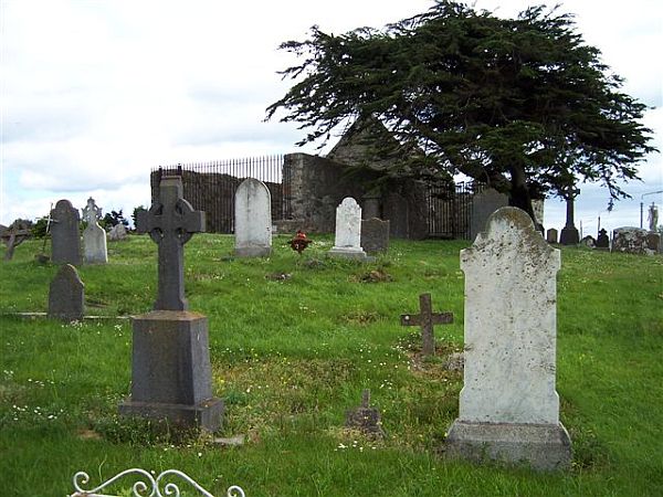 Killeen Burial Gd (Disused )Burial ground · 1 yd
 IndicatedFairy fort / earthen ringfort · 691 yd
 Lissangle Castle (Site of)Castle, unclassified · 1.3 mi
 Ilen Househouse · 1.4 mi
 Hollybrook MillMill, unclassified · 1.5 mi
 Ballyourane Castle (in Ruins)Castle, unclassified · 2.7 mi
 Heritage CentreMuseum · 2.8 mi
 Bishop MahonyMemorial · 2.9 mi
 Monterey CypressMonterey Cypress · 3.7 mi
 Irish Sky GardenHeritage attraction · 4.5 mi
 Wild Atlantic WayVisitor information · 4.8 mi
 Mannin BegIslet · 5.8 mi