What is recorded here
Burial Gd. wraps Kilmacrehy Church on three sides within a mortared limestone wall, facing open water and sky. Ledger slabs, two mausolea and a porch-side chamber fill the south and east, while a bullaun stone sits barely fifteen metres from the church. The graveyard has been extended twice, suggesting the bay kept giving up people and the wall kept moving to hold them.
In gently sloping pasture on the N-shore of Liscannor Bay with extensive views to E, S and W. Shown as an L-shaped graveyard wrapped around to the E, S and W of ‘Kilmacrehy Church’ (CL015-083001-) and labelled ‘Burial Gd’ on the first (1840) and ‘Graveyard’ on the Cassini (1916) edition of the OS 6-inch map. An L-shaped graveyard (dims. 52m E-W; 24m N-S) is enclosed by a mortared limestone wall. Burials marked by ledger slabs and headstones are concentrated to the S and E of the church. Two mausolea stand to the SE of the church, and a third abutts the W wall of the church porch. The graveyard has been extended to the NW, S and W.
There is a bullaun stone (CL015-083003-) within the graveyard, c. 15 W of the church. Tobermacrehy (CL015-081----), a holy well associated with Saint Mac Creiche is c. 465m to the W and ‘Mac Creehy’s Bed’ (CL015-084----), a natural outcrop of rock in Liscannor Bay with folkloric association with the saint (De Paor 1979, 95) is c. 405m to the S.
Compiled by: Gearóid Conroy and Eve Campbell
Date of upload: 8-10-2025
The monument record does not grant public access. Check the route and ask the landowner before entering private land.
- What survives
- Recorded monument
Places near here
 Kilmacreehy Ch. (in ruins)Church · 5 yd
 IndicatedFairy fort / earthen ringfort · 362 yd
 Enclosure in LaghcloonEnclosure · 510 yd
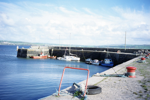 harbour/dock/portharbour/dock/port · 1072 yd
 John P. Holland CentreMuseum · 1520 yd
 Lahinch BeachBeach / strand · 1589 yd
 Liscannor Castle (in Ruins)Castle, tower house · 1688 yd
 Dough CastleRuins · 1.1 mi
 Bridget's Well;St Bridget's WellSpring · 2.0 mi
 Kilmanahn GraveyardRuins · 2.4 mi
 Famine MemorialMemorial · 2.6 mi
 Liscannor BayBay · 2.7 mi