What is recorded here
Killinny holds two lost churches, one on each bank of the King's River, but the southern churchyard still whispers through a field called Church Land. A sandpit opened there and collapsed into a chamber of bones, forcing the diggers to leave. The river may have taken the stones and names, yet the earth remembers what it swallowed.
According to Carrigan (1905, vol. 3, 382), ‘The site of another very ancient church and churchyard is pointed out in the small tract of Killiny lying south of the King’s River, in a field bearing the very suggestive name of Farran-na-hogglisha, Fearann na hEaglaise, or Church Land. The church that stood here, like that on the oppositie bank of the river, has been obliterated. The western boundary of the churchyard is marked by a sandpit, which was opened here several years ago, but had to be abandoned by the workmen owing to the vast amount of human bones they came upon’. This church is also mentioned by Commins (1906, 271) as, 'A short distance above the village [Kells], on the side of the King's River, stood the Church of Killiney, which Dr. O'Donovan considered to be the Cill Funuche in Ossory, which the Four Masters say was burned by a party of Danes in the year 837'. The church (KK027-064001-) and graveyard (KK027-064002-) on the N side of the Kings River are unlocated. The precise location of this graveyard and associated church (KK027-063001-), in the portion of Killinny townland S of the Kings River is unknown.
Compiled by: Jean Farrelly
Date of upload: 18 April 2023
The monument record does not grant public access. Check the route and ask the landowner before entering private land.
- What survives
- Recorded monument
Places near here
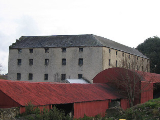 Killinny Corn Millmill (water) · 657 yd
 Glory Bridgebridge · 689 yd
 Lacken WellSpring · 933 yd
 CastleCastle, unclassified · 1225 yd
 Famous Horses of KellsMemorial · 1340 yd
 Kells Priory Mill MuseumMuseum · 1397 yd
 Kells Loop WalkWalking route · 1569 yd
 Water TowerCastle · 1.0 mi
 CrossCross, Market cross · 1.0 mi
 Kells Augustinian PrioryHeritage attraction · 1.0 mi
 Font in Glebe (kells By.)Font · 1.1 mi
 Ballyda Holy WellSpring · 2.1 mi