What is recorded here
On flat ground in terrain gently undulating to E. W end of long rectangular field is occupied by earthworks. These earthworks bear some resemblence to those indicated on the 2nd (1906) ed. OS 6-inch map. At least nine separate enclosures were identified (TS077-015003-, TS077-015004-, TS077-015005-, TS077-015006-, TS077-015007-, TS077-015008-, TS077-015009-, TS077-015010-, TS077-015011-). Immediately E of enclosure (TS077-015008-). Mid-way along the S side of the field there is a large area (dims. 90m E-W; 43.5m N-S) defined by a bank along the W edge and by scarp along the N and E edges. The S portion of this area has been truncated by a farm road. An enclosure (TS077-015008-) abuts the W edge and enclosure (TS077-015010-) abuts the E edge, with enclosure (TS077-015009-) between them. Enclosure (TS077-015010-) consists of a roughly square area (dims. 41m E-W) defined by scarp to N which becomes steeper to E. The scarp on the E side (H 0.93m) is quite substantial. A post and wire fence runs N-S immediately E of this. It is defined by a field boundary to the S.
Compiled by: Jean Farrelly
Date of revised upload: 10 December 2014
The monument record does not grant public access. Check the route and ask the landowner before entering private land.
- What survives
- Recorded monument
Places near here
 Platform in GrangebegPlatform · 105 yd
 Supposed Site of ChurchChurch · 123 yd
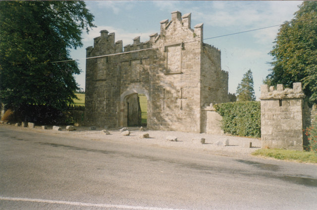 Kiltinan Castlegates/railings/walls · 529 yd
 Loughcapple Bridgebridge · 615 yd
 Pedunculate OakPedunculate Oak · 1604 yd
 CastleCastle, Anglo-Norman masonry castle · 1668 yd
 Killusty CastleCastle · 1.5 mi
 Persian WalnutPersian Walnut · 1.5 mi
 CarrickbrockMountain / peak · 2.2 mi
 CarrigdotiaMountain / peak · 2.3 mi
 East GateMemorial · 3.2 mi
 CarrigaunEnclosure · 534 yd