What is recorded here
In tillage. Visible on Bing Maps Aerial view (pers. comm. P. Reid) a small circular area (est. diam. c. 10m) defined by the cropmark of a back-filled fosse. Possibly the remains of a ring-barrow.
Compiled by: Gearóid Conroy
Date of upload: 12 November 2014
A Neolithic ring-barrow, c. 2500–2000 BCE, likely representing an early form of burial monument with potential significance in ritual or social structure. Its identification through cropmarks highlights the value of remote sensing in locating prehistoric sites.
The monument record does not grant public access. Check the route and ask the landowner before entering private land.
- What survives
- Recorded monument
Places near here
 Church in GeraldineChurch · 421 yd
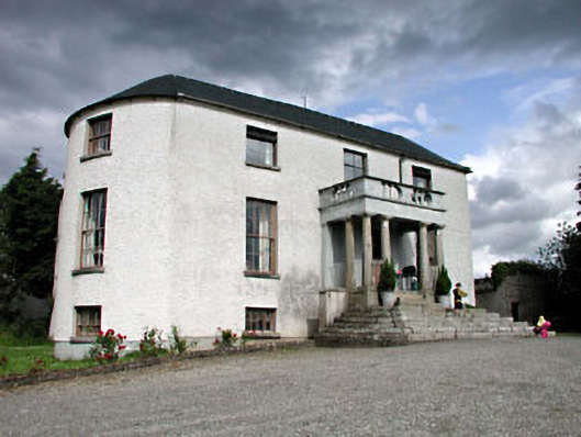 Geraldine Housefarm house · 527 yd
 Enclosure in SawyerswoodEnclosure · 921 yd
 EnclosureEnclosure, large enclosure · 1050 yd
 Scots PineScots Pine · 1346 yd
 Athy War MemorialMemorial · 1.6 mi
 Bawn in Townparks (athy West Urban Ed)Bawn · 1.7 mi
 Woodstock CastleRuins · 1.7 mi
 Zoltan Zinn-Collis memorialMemorial · 1.7 mi
 Town HallMuseum · 1.8 mi
 European BeechEuropean Beech · 1.9 mi
 History of Moat of ArdscullVisitor information · 1.9 mi