What is recorded here
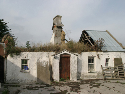
Detached four-bay single-storey lobby entry thatched farmhouse, extant 1840, on a rectangular plan off-centred on single-bay single-storey gabled windbreak. Occupied, 1990. Now in ruins. Hipped roof now missing with traces of chicken wire-covered oat thatch on collared split bough construction, rendered red brick Running bond off-central chimney stack having corbelled stepped capping, and blind stretchers to eaves having blind scallops. Limewashed rendered battered walls with cement rendered battered buttresses to front (east) elevation. Square-headed off-central door opening in camber- or segmental-headed recess with concrete threshold, and concealed dressings framing timber boarded door. Square-headed window openings with concrete or rendered sills, and concealed dressings including timber lintels framing two-over-two timber sash windows having part exposed sash boxes. Set perpendicular to road with cylindrical piers to perimeter having rendered domed capping supporting corrugated-iron gate.
The ruins of a farmhouse identified as an integral component of the vernacular heritage of south County Wexford by such attributes as the alignment perpendicular to the road; the rectilinear lobby entry plan form off-centred on a characteristic windbreak; the construction in unrefined local materials displaying a battered silhouette with a deteriorating surface finish revealing sections of "daub" or mud; and the high pitched roof showing traces of an oat thatch finish. Furthermore, adjacent "tin roofed" outbuildings (extant 1840) continue to contribute positively to the group and setting values of a neat self-contained ensemble making a picturesque, if increasingly forlorn visual statement in a rural street scene.
This does not grant access. Most recorded buildings are privately owned; view them only from public ground unless the owner allows entry.
Places near here
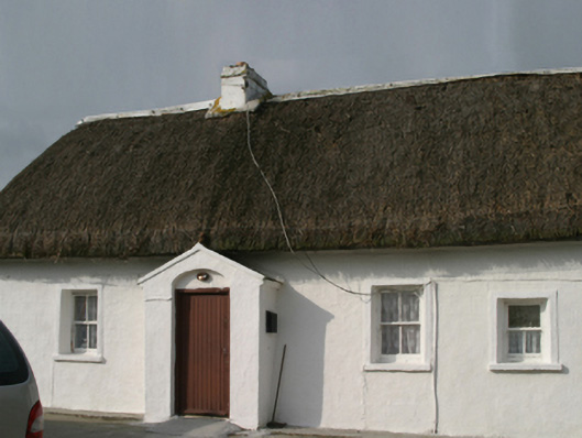 farm housefarm house · 258 yd
 Harpoonstown Housefarm house · 1035 yd
 St. Fintans WellHoly well · 1308 yd
 Castle (Site of)Castle, unclassified · 1.1 mi
 Not idnicatedChurchyard · 1.3 mi
 Castle (in ruins)Castle, tower house · 1.5 mi
 The Heron's MeadowForest · 2.6 mi
 The Bull RockForest · 2.7 mi
 Irish Agricultural MuseumMuseum · 2.9 mi
 1798 Memorial PlaqueMemorial · 3.0 mi
 Skeater RockMountain / peak · 3.8 mi
 Carrickatinna RockMountain / peak · 3.9 mi
Other information
Photo: National Inventory of Architectural Heritage · Website use allowed for educational or private purposes with source credit