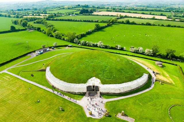
What is recorded here
Located on the floodplain on the N bank of a W-E section of the River Boyne, c. 100m from the river in Brú na Bóinne. Exceptionally dry weather conditions during June / July 2018 brought out the cropmark of a circular enclosure (diam. c. 40m) defined by a single narrow fosse feature, which is visible SW-NW-NE and was first photographed by Anthony Murphy using a drone-mounted camera. It is located between the embanked enclosure (ME026-006----) c. 30m to the ESE and the ceremonial enclosure (ME026-033----), which is c. 20m to the WNW, and it appears to overlie the arc of the detached fosse associated with (ME026-033----).
Compiled by: Michael Moore
Date of upload: 16 July, 2018
A fairy fort or earthen ringfort near Newgrange, likely dating to the early medieval period, is situated within the Brú na Bóinne complex, an area of significant prehistoric and mythological importance. The site's association with fairy folklore and its proximity to Neolithic monuments like Newgrange suggest a long-standing cultural and spiritual significance in Irish tradition.
The monument record does not grant public access. Check the route and ask the landowner before entering private land.
- What survives
- Recorded monument
Places near here
 DronehengeArchaeological place · 104 yd
 Embanked enclosure in NewgrangeEmbanked enclosure · 174 yd
 NewgrangeHeritage attraction · 794 yd
 Mill Housemill (water) · 920 yd
 Boyne Currach CentreHeritage attraction · 1314 yd
 Catholic Church of the Nativity of Our Ladychurch/chapel · 1578 yd
 Knowth Fox CovertWood · 1704 yd
 Brú na Bóinne Visitors CentreVisitor information · 1.2 mi
 Dowth CastleCastle, tower house · 1.7 mi
 Glenmore ForestWood · 2.3 mi
 Proudfootstown CastleCastle, unclassified · 2.6 mi
 RiverviewMemorial · 2.9 mi
Other information
Photo: Credit not shown in the picture search · Rights wording not checked; contact us if this picture should be removed