What is recorded here
No visible gate, no broken stone, no human marker at all. The earth simply stops being claimable beyond that ridge. What looks like a fort may be a boundary the land drew around itself, excluding every human certainty it can hold.
In level pasture. Circular area (diam. c. 30m) defined by scarped edge (H 2.35m; Wth 4m) with an external fosse (D 1.3m; Wth 2.05m). A field boundary runs along outer edge of fosse SE->NE; this connects to a N-S running public road 15m to E. Interior level and covered by dense overgrowth.
Compiled by: Denis Power
Date of upload: 26 August 2011
A fairy fort / earthen ringfort in Mahoonagh More is a circular early-medieval defensive or domestic site, likely dating to between the 5th and 10th centuries AD. Local tradition associates such sites with the fairy folk, and they were often avoided or revered in rural folklore.
The monument record does not grant public access. Check the route and ask the landowner before entering private land.
- What survives
- Recorded monument
Places near here
 Enclosure in Mahoonagh BegEnclosure · 521 yd
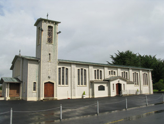 Catholic Church of Saint John the Baptistchurch/chapel · 975 yd
 Mahoonagh Church (in ruins)Church · 1140 yd
 Castle MahonCastle · 1221 yd
 BarrowBarrow, ring-barrow · 1311 yd
 Ballynoe Castle (in ruins)Castle, tower house · 1.9 mi
 Garbally WellSpring · 3.1 mi
 LaghtpatrickSpring · 3.4 mi
 European ashEuropean ash · 3.8 mi
 Ballagh MountainMountain / peak · 6.0 mi
 Limerick GreenwayWalking route · 6.2 mi
 Sugar HillMountain / peak · 7.2 mi