
What is recorded here
South-of-centre in graveyard (LI036-17202-). Roofless ruin of rectangular church (9.1m N-S; 23.2m E-W), built of uncoursed limestone rubble. Walls stand mostly to full height, but NE corner isolated by two vertical cracks; walls partially ivy-clad.
Very ruined doorway W-of-centre in S wall (ground level outside doorway c. 0.25m higher than inside). Interior lit by four windows: in centre of E gable; high up on W gable; and two in S wall, both E-of-centre. East window has light with simple Y-tracery; embrasure deeply splayed with pointed top reflecting form of window light. A number of inside edge stones are sandstone blocks with edge moulding, reused from earlier window. Light covered by hood moulding with plain stepped terminals. West window now obscured by ivy, but has/had a plain single light (OSL vol. 2, 18). Easternmost window in S wall has single round-arched light with a plain hood moulding following shape of arch; both arch of light and hood (except terminals) carved on single stone (see OSL vol. 2, opp. 17; Westropp 1904-5, plate 10). Embrasure deeply splayed with round arch. Second window short distance to W is an insertion; light largely missing but probably rectangular, embrasure covered by segmental arch. Very close to SE corner is aumbry/piscina in S wall: rectangular recess missing its base; outside edge chamfered; lintel with square cut-out on under-surface. Opposite in N wall is tomb niche, now partially obscured by ivy. Semi-circular arch, with moulded edge, covers recess (D c. 0.2m); outer edge of moulding carried up as ogee-arch topped by finial; similar finial atop thin pilasters rising from either side of arch. Tomb is 15th/16th century in style. Interior covered in burial plots; earliest headstone dated 1860, most recent 1990. Ruin of medieval parish church of Mahoonagh (Westropp ibid., 414).
Compiled by: Denis Power
Date of upload: 26 August 2011
See attached ASI aerial photograph ASIAP – 325/9, 11, 12, 13 on 05/10/2002.
The monument record does not grant public access. Check the route and ask the landowner before entering private land.
- What survives
- Recorded monument
Places near here
 Castle MahonCastle · 185 yd
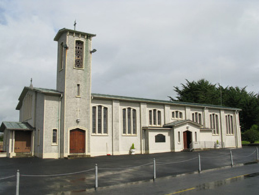 Catholic Church of Saint John the Baptistchurch/chapel · 299 yd
 Enclosure in Mahoonagh BegEnclosure · 623 yd
 water pumpwater pump · 632 yd
 BarrowBarrow, ring-barrow · 1.3 mi
 Ballynoe Castle (in ruins)Castle, tower house · 2.2 mi
 Garbally WellSpring · 3.0 mi
 Sunday WellSpring · 3.8 mi
 European ashEuropean ash · 4.4 mi
 Ballagh MountainMountain / peak · 5.4 mi
 Limerick GreenwayWalking route · 6.3 mi
 Sugar HillMountain / peak · 7.1 mi
Other information
Photo: Credit not shown in the picture search · Rights wording not checked; contact us if this picture should be removed