What is recorded here
Thirty metres across on the lower slopes of Brandon mountain, the oval rath in Baile Na Leacan still commands a sweeping view along the Owenmore valley and across Brandon Bay. A disused laneway cuts the site into two unequal portions, yet the larger northwest section keeps its earthen bank, reaching nearly two metres high around a gently sloping interior marked only by unnamed mounds and hollows. The name fairy fort suggests more than human memory, but the visible bank and northern gap point to a lived-place where someone shaped the hillside, watched the water, and left the rest behind.
Internal diam. 30m WSW-ENE, c. 21m NNW-SSE
This oval rath is situated on the lower E slopes of Brandon mountain and commands a sweeping view along the Owenmore valley and across Brandon Bay as far as the central mountain ridge of the peninsula. A disused laneway runs ENE-WSW across the site, dividing it into 2 unequal portions. The larger NW portion is enclosed by a single earthen bank up to 1.8m high and an average of 1.33m wide at base. There is a featureless gap, .65m wide, at N. To SE of the lane, the bank has been removed, but the outline of the enclosure is preserved as a scarp which rises up to 1.8m above the external ground level. A low, narrow bank or wall skirts the edge of the platform, at a distance of c. 1.3m; this is a later feature, possibly defining a path around the site. The interior slopes gently downhill to SE and contains mounds and hollows which form no recognisable pattern. An Seabhac (1939, 227) recorded a Man-made underground passage in a ringfort in this townland, but it is not clear to which of the 3 known ringforts he refers.
The above description is derived from J. Cuppage, ‘Corca Dhuibhne. Dingle Peninsula archaeological survey. Ballyferriter. Oidhreacht Chorca Dhuibhne’ (1986), no. 334. In certain instances the entries have been revised and updated in the light of recent research.
Date of upload: 6 August 2013
This remains an important historical record, but the official description says the monument is no longer visible or has been destroyed. The monument record does not grant public access. Check the route and ask the landowner before entering private land.
- What survives
- No visible remains or recorded as destroyed
Places near here
 Na GalláinArchaeological place · 245 yd
 Fairy fort / earthen ringfort in Baile Na LeacanFairy fort / earthen ringfort · 1299 yd
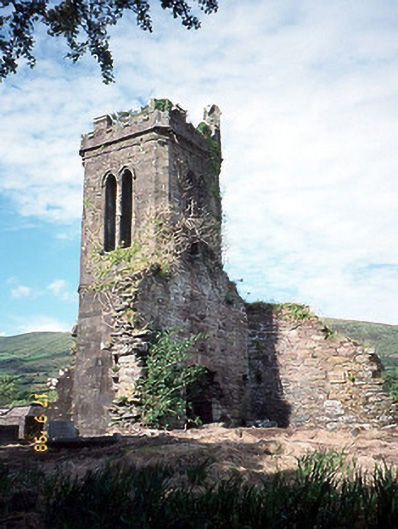 Séipéal an Clochán [Cloghane Church]church/chapel · 1446 yd
 Cloghane ChurchRuins · 1446 yd
 An CheapaighBeach / strand · 1692 yd
 An t'Oileán DubhIslet · 1.1 mi
 Drom BeachBeach / strand · 1.5 mi
 Pointe na CathrachHeadland · 1.8 mi
 An Sliabh GlasMountain / peak · 2.3 mi
 Cnoc DuíléibheMountain / peak · 2.3 mi
 Site of CastleCastle, unclassified · 2.3 mi
 World War II plane crash site: Engine of Focke-Wulf Fw 200 CondorHeritage attraction · 2.3 mi