What is recorded here
Indicated is a ruined earthen ringfort on a Mayo ridge, reduced in 2004 when a wide pit cut through its centre. Before that loss, its low circular platform stood beside a stream valley, offering views along the land and north-west over bog. The fort may have marked residence, boundary or ritual life, but excavation removed the shape that would have answered such questions.
In pasture, located on a N−S ridge bordering the W side of a stream valley. It is sited close to the break of slope on the E side of the ridge where the ground falls steeply to the banks of the stream. There are good views along the valley and N−NW over a tract of bogland.
When inspected in 1997, the rath was evident as a low sub-circular platform (26.6m N−S; 28m E−W) defined by a broadly sloping scarp (Wth slope 5-6m; H 0.7m at W, 1.4m at E). The scarp appeared to have been partly levelled in the past, and there were areas of shallow disturbance/quarrying along its N and S edges. In 2004 the rath was severely damaged when a large subrectangular pit (24m E−W; 12m N−S at E end, 6.5m N−S at W end; D 2m) was dug into the interior, extending through the centre across its full E−W extent.
Compiled by: Jane O’Shaughnessy
Date of upload: 25 November 2020
The monument record does not grant public access. Check the route and ask the landowner before entering private land.
- What survives
- Recorded monument
Places near here
 bridgebridge · 748 yd
 IndicatedFairy fort / earthen ringfort · 1.0 mi
 Enclosure in KillaturlyEnclosure · 1.9 mi
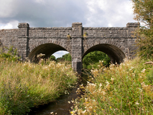 Sonnagh Bridgebridge · 1.9 mi
 Procession Of The SoulsMemorial · 2.5 mi
 Brabazon WoodsForest · 2.6 mi
 Youth Memorial GardenMemorial · 2.9 mi
 HawthornHawthorn · 3.8 mi
 Castle (in Ruins)Castle, unclassified · 4.2 mi
 Hennigan's Heritage CentreHeritage attraction · 4.3 mi
 Thorn CaveCave · 5.6 mi
 Old Cave Burial GroundArchaeological place · 8.4 mi