What is recorded here
Fairy forts disguise human ingenuity as magical mystery. This is a ringfort: a made place, likely lived in, built with thought and labour. The fairies enter later as a story people told when they no longer understood the shape. That is not the same as claiming the trick is finished.
Situated at the crest of the E-facing slope of a small drumlin. This is a grass and rush-covered circular area (diam. 23.5m NE-SW; 22.8m NW-SE) defined by an overgrown earthen bank (Wth 2.3-2.7m; int. H 0.3-0.6m; ext. H 0.5m) N-E-SW, which is reduced to a scarp (H 0.6m at SE to 1.2m at SW) elsewhere. The original entrance is not identified.
The above description is derived from 'The Archaeological Inventory of County Leitrim' compiled by Michael J. Moore (Dublin: Stationery Office, 2003). In certain instances the entries have been revised and updated in the light of recent research.
Date of upload: 23 September 2008
The monument record does not grant public access. Check the route and ask the landowner before entering private land.
- What survives
- Recorded monument
Places near here
 Fairy fort / stone ringfort in CleighranFairy fort / stone ringfort · 1193 yd
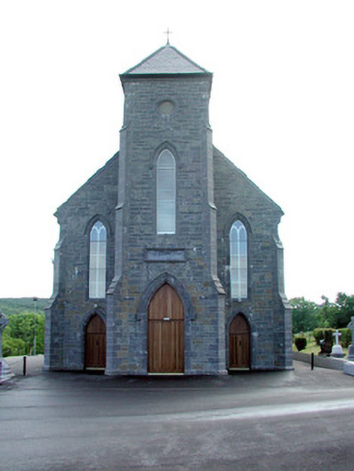 Saint Mary's Catholic Churchchurch/chapel · 1259 yd
 St. Michaels ChurchChurch · 1.2 mi
 Corn kilnSweathouse · 1.2 mi
 MoteCastle, motte · 1.3 mi
 Old HallCastle, hall-house · 1.7 mi
 Cullentra ForestForest · 2.7 mi
 SlishwoodWood · 3.1 mi
 Trawane BayBay · 3.1 mi
 InnisfreeIslet · 3.1 mi
 Slishwood Island WestIslet · 3.8 mi
 Giants GraveArchaeological place · 3.8 mi