What is recorded here
Indicated is a probable rath in County Cavan, preserved only as a low earthen bank and deep trench beside a drumlin ridge. It resists easy description because its boundary merges with a townland line and its field name still carries the idea of a fort. The land may have held a household, a boundary marker or a forgotten claim, while the trench cut through soil and memory alike.
Not marked on OS 1836 or 1876 eds. Known as the 'fort field' (local information). Subrectangular area (int. dims. 37m E-W; 32.2m N-S) enclosed by a low modern-looking earthen bank with the exception of E quadrant where it is bounded by a deep trench which is coterminous with the townland boundary. Situated close to the base of a drumlin ridge overlooked by rising ground. Probably the site of a rath.
The above description is derived from the published 'Archaeological Inventory of County Cavan' (Dublin: Stationery Office, 1995). In certain instances the entries have been revised and updated in the light of recent research.
Date of upload/revision: 22 December 2008
The monument record does not grant public access. Check the route and ask the landowner before entering private land.
- What survives
- Recorded monument
Places near here
 Corgarran ForestForest · 1059 yd
 BellvilleMountain / peak · 1610 yd
 Fleming's FollyForest · 1635 yd
 Castle CosbyCastle, unclassified · 1.1 mi
 Enclosure in DrumconnickEnclosure · 1.1 mi
 Tonymore CrannogArchaeological place · 1.1 mi
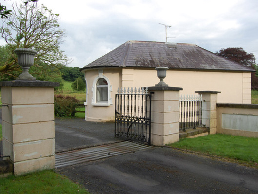 gate lodgegate lodge · 1.2 mi
 Church in Cashel (clanmahon By.)Church · 1.4 mi
 CastleCastle, motte and bailey · 1.6 mi
 Carricknagore RockNamed rock · 2.1 mi
 Owen Roe O'Neill graveMemorial · 2.4 mi
 DrumcarbanMountain / peak · 2.8 mi
Other information
Photo: Credit not shown in the picture search · Rights wording not checked; contact us if this picture should be removed