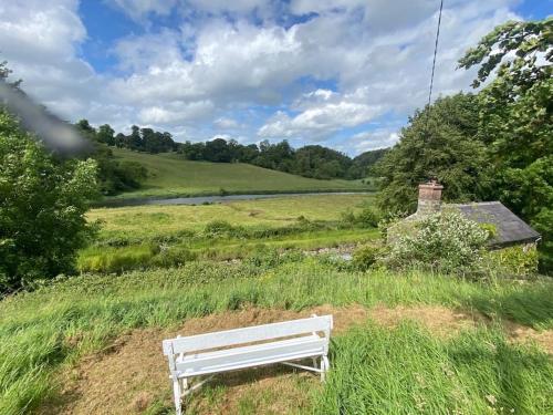
What is recorded here
Thirty years of ploughing and rain erased the ringfort in Donore, yet satellites still catch its shadow. The main circle measures fifty metres across, with a second fainter ring at seventy metres and a kidney-shaped annexe bulging east. A farmer bulldozed the visible stones and wall decades ago, believing he was clearing debris rather than destroying a home. The land forgot the shape of the settlement while the sky kept it safe.
The following description is derived from the published 'Archaeological Inventory of County Carlow' (Dublin: Stationery Office, 1993). In certain instances the entries have been revised and updated in the light of recent research.
Date of upload/revision: 17 July 2007
Circular enclosure with annexe. Aerial photographs (CUCAP BDH 91-92, BDO 58) show broad, well-marked cropmark of fosse (est max. diam. c. 50m) with fainter and much narrower, external but concentric fosse (est max. diam. c. 70m), enclosing kidney-shaped annexe at E (est max. diam. if arc complete c 45m). No evidence for causeway. No visible surface traces. 'Circular ring of stones' and 'wall' reported as having been bulldozed c 20 years ago. Possibly a ringfort with annexe.
The monument record does not grant public access. Check the route and ask the landowner before entering private land.
- What survives
- Recorded monument
Places near here
 Kilmolappoge Church (site of), Kilmolappoge WellChurch · 837 yd
 Enclosure in GlannaharyEnclosure · 983 yd
 Wych ElmWych Elm · 1679 yd
 Lorum Church (in ruins)Church · 1.3 mi
 Good Shepherd Church (Lorum)church/chapel · 1.3 mi
 The Columban WayVisitor information · 1.7 mi
 Ballyloughan Castle (in ruins)Castle, Anglo-Norman masonry castle · 1.9 mi
 Lock Keeper's House and Lodge MillsVisitor information · 1.9 mi
 Ballymoon Castle (in ruins)Castle, Anglo-Norman masonry castle · 2.0 mi
 Sweet ChestnutSweet Chestnut · 2.2 mi
 Church (in ruins), GraveyardChurch · 2.3 mi
 Church, GraveyardChurch · 3.9 mi
Other information
Photo: Credit not shown in the picture search · Rights wording not checked; contact us if this picture should be removed