What is recorded here
Fairy fort / earthen ringfort in Curraghbrack is a fairy fort or earthen ringfort in Curraghbrack, County Westmeath, Ireland. The 1970 record described this roughly circular site as measuring 34 meters east-west and 33 meters north-south, enclosed by a bank that has been denuded down to a scarp in places. This bank is fragmentary, with two small quarried depressions at the east and modern field boundaries incorporated into it from northwest through north to northeast. The original entrance is not recognisable, and modern trackways cross the scarp at the south and west-northwest.
Situated on a slight rise in gently undulating and hilly pasture, with extensive views in all directions. Depicted on the 1837 ed. OS 6-inch map as an oval-shaped earthwork. Depicted on the revised 1913 ed. OS 25-inch map as a modified roughly oval-shaped earthwork incorporated into field boundaries from NW-N-NE.
Monument described in 1970 as a roughly circular-shaped area (dims. 34m E-W; 33m N-S) enclosed by a bank which has been denuded down to a scarp in places and vague traces of an outer fosse. The bank is fragmentary in general and has been steepened in modern times from NW-N-NE, where there is a modern field bank on its upper edge, as depicted on the revised 1913 ed. OS 25-inch map. There are two small quarried depressions in the bank at E. A modern fence running NNE-SSW intwersects the bank at SSW and from SSW-W-NW there is a modern wire fence along the bank. The original entrance is not recognisable. There is a modern trackway across the scarp at S and at WNW. The interior rises from the perimeter towards the centre and has traces of cultivation ridges running NNW-SSE. Monument is visible today as a roughly oval-shaped tree-lined earthwork on Digital Globe aerial photography.
Compiled by: Alison McQueen, Vera Rahilly and Caimin O’Brien
Date of upload: 18 February 2019
The monument record does not grant public access. Check the route and ask the landowner before entering private land.
- What survives
- Recorded monument
Places near here
 IndicatedFairy fort / earthen ringfort · 710 yd
 EnclosureEnclosure, large enclosure · 1241 yd
 Site of CastleCastle, unclassified · 1756 yd
 Church (in Ruins)Church · 1.0 mi
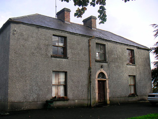 Newgrove Housefarm house · 1.3 mi
 Long PlantingForest · 1.9 mi
 CastleCastle, unclassified · 2.4 mi
 Saint Brigid's WellSpring · 2.7 mi
 United Nations War MemorialMemorial · 2.9 mi
 Scragh Bog Nature ReserveNature reserve · 3.3 mi
 Church IslandIsland · 3.5 mi
 Srudarra IslandIslet · 4.1 mi