What is recorded here
You can still see the church mound in Clonegall, three metres high and ringed by an old ditch, though the graveyard has eaten part of the bank. A ruined chapel stood there when surveyed in 1650, and a new church was built on the same mound later. The graveyard has a granite cross base and a quern stone brought into the present church, while the mound may have begun as a ringfort rather than a church at all.
The following description is derived from the published 'Archaeological Inventory of County Carlow' (Dublin: Stationery Office, 1993). In certain instances the entries have been revised and updated in the light of recent research.
Date of revision: 16 December 2009
Revised by: J. Farrelly
Tickell (JKAS 1960, 408) mentions reference to church or chapel in 'Moyacan' now Clonegall, in Royal Grant of 1627 to Sir Maurice Eustace. Down Survey records church as 'ruined' in 1650. Present remains consist of central raised mound (H c. 3m) enclosed by fosse with external bank visible from W-N-NE, elsewhere modified by extention of graveyard (CW018-016006-). Nineteenth-century church now stands on mound. Cross base of socketed squared granite boulder. Quern stone found in graveyard in 1902 (JAPMD 1905, 192) and placed in present church. Earthwork is probably ringfort in origin although also resembles modified motte.
The monument record does not grant public access. Check the route and ask the landowner before entering private land.
- What survives
- Recorded monument
Places near here
 Saint Fiacc's Church (Moyacomb)church/chapel · 1 yd
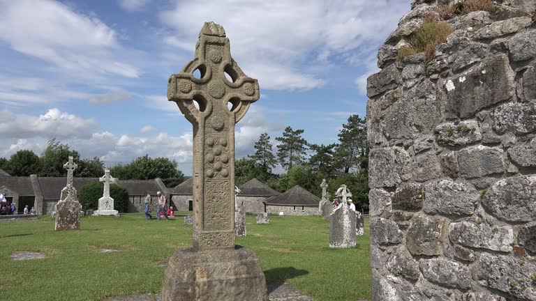 Cross in ClonegallCross · 21 yd
 Saint Brigid's Catholic Churchchurch/chapel · 414 yd
 Enclosure in ClonoganEnclosure · 747 yd
 Clonogan Castle (site of)Castle, unclassified · 762 yd
 Common LimeCommon Lime · 836 yd
 Huntington Castle & GardensHeritage attraction · 1017 yd
 European YewEuropean Yew · 1046 yd
 Barragh Church (in ruins), GraveyardChurch · 1.9 mi
 Gibbet HillMountain / peak · 2.5 mi
 1798 rebellion Battle of Newtownbarry (AKA Bunclody) commemorative plaqueMemorial · 3.0 mi
 Bunclody 1798 Bicentenary MemorialMemorial · 3.0 mi