What is recorded here
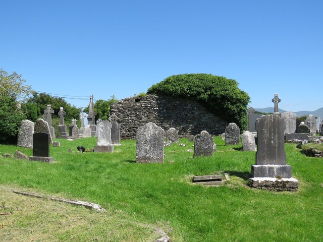
Westropp (1904-5, 452-3) recorded the following details about Ballingarry Church also known as Garth; 'Garthegrifnn, in Natherlach, 1291; Garthe, in Natherlagh, 1302. Alicia, widow of Griffin de Rupe, had a suit about lands, a mill, turbary, and pasture in Garthegriffin and Olethere, Kilboygnam, and O'Tran; elsewhere given as Garthegriffen, in Olehere; Foxnoceston, in Any; and Olethill, in Kilboynagh, 1294-7 (Plea R. 22 of xxv Ed. I, m. 48; 32, m. 7,and 36 of xxvi, m. 20). Ballingarrie Church, 1607 (Pat. R.). "There is noe habitacon or other thing remarkable in this parish, save only a mill seate and the walls of a church upon the lands of Ballingarry," 1656 (D.S. (A), 53). Fabric - The west gable of a rude ruined church near SS. Peter's and Paul's Well [LI049-108----], 20 feet 3 inches [6.2m] wide : featureless'.
Compiled by: Caimin O'Brien
Date of upload: 26 June 2019
Ballingarry Church, also known as Garth, was likely built in the late 13th or early 14th century, with references dating to 1291 and 1302. It is associated with the de Rupe family and reflects early medieval ecclesiastical architecture in the region.
The monument record does not grant public access. Check the route and ask the landowner before entering private land.
- What survives
- Recorded monument
Places near here
 Grave YardGraveyard · 8 yd
 St. Peters & St. Pauls WellHoly well · 182 yd
 Saint Patrick's Catholic Churchchurch/chapel · 623 yd
 bridgebridge · 997 yd
 SlievereaghMountain / peak · 1.3 mi
 Duntryleague - hachuredCastle, ringwork · 1.9 mi
 Site of Castle, Castle FieldCastle, unclassified · 2.0 mi
 Saint Patrick's WellSpring · 2.0 mi
 Edmund's WellSpring · 2.4 mi
 Ballinvreena LoopVisitor information · 2.7 mi
 Darby's Bed Walk LoopWalking route · 2.8 mi
 Duntryleague HillMountain / peak · 2.8 mi