What is recorded here
Killanafinch holds a steep oval motte above a fast river, its flat top spanning nineteen metres and rising two metres above the pasture. A narrow fosse cuts through bedrock at the northeast and southwest, suggesting people dug the defence rather than nature forming it. The mound still stands beside another earthwork to the southeast, waiting for a rider, a guard, or a child climbing its grassy slope to imagine the life lost inside the soil.
Situated on a W-facing slope in rolling pastureland with a fast-flowing river (E-W) immediately to the S and a motte (TN027-018----) to the SE. An oval, steep-sided, flat-topped (19m N-S; 11m E-W; H 2.64m) earthen mound (base diam. 25.8m N-S; 19.4m E-W) enclosed by a fosse (Wth 4.2m; D 0.7m) visible around the base at NE and SW which appears to be cut into bedrock. Limited quarrying has taken place in the SE quadrant.
The above description is derived from 'The Archaeological Inventory of County Tipperary. Vol. 1 - North Tipperary' compiled by Jean Farrelly and Caimin O'Brien (Dublin: Stationery Office, 2002). In certain instances the entries have been revised and updated in the light of recent research.
Date of upload/revision: 22 September 2008
The monument record does not grant public access. Check the route and ask the landowner before entering private land.
- What survives
- Recorded monument
Places near here
 IndicatedCastle, motte · 294 yd
 Enclosure in Poulakerry (kilkeary Par.)Enclosure · 1139 yd
 Interragh HillMountain / peak · 1579 yd
 Enclosure in Lackenavorna,tiermoyleEnclosure · 1754 yd
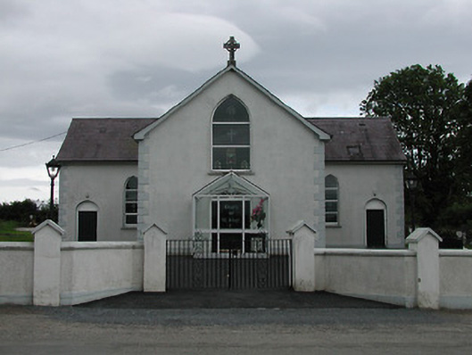 Saint Joseph's Catholic Churchchurch/chapel · 1.1 mi
 Grenanstown Househouse · 1.3 mi
 Latteragh Castle (in ruins)Castle, Anglo-Norman masonry castle · 1.7 mi
 Knockacraheen HillMountain / peak · 1.9 mi
 Killavalla WoodForest · 2.1 mi
 Kyleroe WoodWood · 3.1 mi
 James Devaney MemorialMemorial · 5.8 mi
 Silvermines ViewpointViewpoint · 7.7 mi