
What is recorded here
Indicated is a field system in Carroweighter, County Roscommon, Ireland. The expanded graveyard of Oran church destroyed northern earthworks marked on the 1929 map and described by O'Donovan around 1837 as house foundations. About 18 acres of the system survive between the graveyard and rath, preserving a rectangular enclosure with attached house site and extensive field banks.
Towards the bottom of the S-facing slope at the SE end of a NW-SE ridge. The expanded graveyard of Oran church (RO034-080001-) has destroyed earthwork features to the N, marked on the 1929 ed. of the OS 6-inch map, and described by O'Donovan c. 1837 as house foundations (O’Flanagan 1931, vol. 1, 61), but traces of a field system covering about 18 acres (c. 7.5 ha) survive in the fields between the graveyard (RO034-080002-) and rath (RO034-081001-). It consists of a rectangular enclosure (RO034-081004-) (int. dims 25m ENE-WSW; 12.5m NNW-SSE) defined by earthen banks (Wth 1.5m; H 0.25-0.35m) on all sides except the SW, with a house site (RO034-081005-) (dims 5.6m x 5.4m) attached to the outside of the bank at NW. Field banks extend NW, NE and S from the corners of the rectangular enclosure, and two other E-W field banks connect with the N-S bank, creating large fields (dims c. 150m E-W; c. 50m N-S). At the N of the extent smaller fields are present.
Compiled by: Michael Moore
Date of upload: 24 August 2010
The monument record does not grant public access. Check the route and ask the landowner before entering private land.
- What survives
- Recorded monument
Places near here
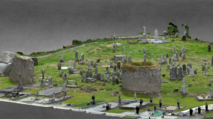 Enclosure in CarroweighterEnclosure · 64 yd
 IndicatedRound tower · 177 yd
 HawthornHawthorn · 235 yd
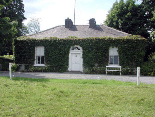 Ballydooley Lodgegate lodge · 852 yd
 Old KilnKiln · 1358 yd
_-_geograph.org.uk_-_1952978.jpg?width=1280) Bawn in Glinsk (ballymoe By.)Bawn · 4.1 mi
Bawn in Glinsk (ballymoe By.)Bawn · 4.1 mi European ashEuropean ash · 4.4 mi
 CastleCastle, Anglo-Norman masonry castle · 4.6 mi
 Site of Killomaine Grave YardArchaeological place · 4.7 mi
 Roscommon CastleCastle · 6.5 mi
 Sally IslandIslet · 7.1 mi
 Mount MaryMountain / peak · 7.5 mi
Other information
Photo: Credit not shown in the picture search · Rights wording not checked; contact us if this picture should be removed