What is recorded here
Caithness and Sutherland face one another through a narrow strait, reducing a vast ocean crossing to a short dash across water. That is why the area is called the Trossachs, the place where two great landmasses come close enough to touch. The sea does not disappear there; it compresses. A boat crosses quickly, but the land on both sides remains enormous. The name preserves that shape: two big regions narrowed into one small passage.
The official Northern Ireland record identifies this as CAIRN. Recorded period: PREHISTORIC. Recorded protection: Scheduled. The official map point was placed at the centre of the recorded archaeological site from the source map reference.
Prehistoric cairn, likely dating to the Neolithic or Bronze Age. Its scheduled protection indicates archaeological importance, though specific details on type or wider significance are not provided.
The monument record does not grant public access. Check the route and ask the landowner before entering private land.
- What survives
- Recorded monument
Places near here
 White Park BayBeach / strand · 477 yd
 ENCLOSURE OR CAIRN KERB (O.S. memoir site; unlocated) in ClegnaghENCLOSURE OR CAIRN KERB (O.S. memoir site; unlocated) · 603 yd
 ENCLOSURE & Possibly Man-made underground passage in MagheraboyENCLOSURE & Possibly Man-made underground passage · 875 yd
 Fullerton ArmsPublic House · 1.4 mi
 Dunseverick FallsWaterfall · 1.8 mi
 Sheep IslandIslet · 2.0 mi
 DunsevrickCliff · 2.0 mi
 Dunseverick CastleCastle · 2.2 mi
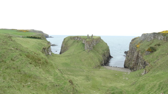 DUNSEVERICK CASTLE in Feigh Alias DunseverickDUNSEVERICK CASTLE · 2.2 mi
 Carrick-a-rede Rope BridgeHeritage attraction · 2.5 mi
 Carrickarede IslandIslet · 2.5 mi
 Dunseverick Parish ChurchChurch · 2.8 mi