What is recorded here
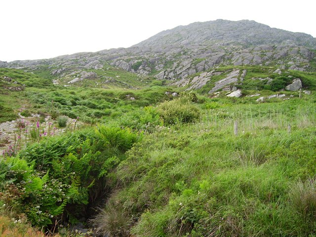
Indicated stretches across thirty hectares on the lower slopes of Knockagallaun, where shallow bog seeps through rough mountain grazing. Single stones mark the field edges without rising like walls, suggesting people shaped the land before the famine rather than merely surviving it. The absence of tall structure invites imagination about hands stacking stone under difficult skies, yet no archive confirms whether neighbours shared the work or one family imposed order on the hill.
In rough mountain grazing with some shallow bog cover on lower N slopes of Knockagallaun. System of fields covering c. 30 hectares. Fences comprise low line of single stones. According to local information they pre-date famine.
The above description is derived from the published 'Archaeological Inventory of County Cork. Volume 1: West Cork' (Dublin: Stationery Office, 1992). In certain instances the entries have been revised and updated in the light of recent research.
Date of upload/revision: 14 January 2009
The monument record does not grant public access. Check the route and ask the landowner before entering private land.
- What survives
- Recorded monument
Places near here
 Enclosure in CaherkeenEnclosure · 154 yd
 Mass RockVisitor information · 170 yd
 Caherkeen Mass RockHeritage attraction · 186 yd
 CairnCairn, unclassified · 778 yd
 Church in CaherkeenChurch · 1336 yd
 KnocknagallaunMountain / peak · 1345 yd
 Old MineRuins · 1.4 mi
 Eagle HillMountain / peak · 1.4 mi
 DooneenViewpoint · 1.6 mi
 Blue IslandsIslet · 1.6 mi
 Black RockIslet · 2.1 mi
 Allihies Copper Mine MuseumMuseum · 2.2 mi
Other information
Photo: Credit not shown in the picture search · Rights wording not checked; contact us if this picture should be removed