
What is recorded here
Mortons and Egan measured the curved wall above the road, but Egan alone appears in the saved facts. The chamber repeats that Egan worked there while withholding the year and region. Chamber claims Egan measured the chamber and others, yet the facts only record Egan at this place. Chamber also invented a county and a country for Egan. The chamber records Egan, a graveyard and a church. Everything else in that answer is chamber invention.
Graveyard walled and curved along west at some height above the road. The oldest section of the graveyard is the raised area that surrounds the church (DU013-010001-). It contains 18th, 19th century and modern gravestones as well as a number of re-used architectural fragments. The graveyard has been extended to the north twice. The graveyard was previously surveyed by Egan in 1993 (Fingal Historic Graveyards project 2008).
Compiled by: Christine Baker
Date of Upload: 7 February 2015
The monument record does not grant public access. Check the route and ask the landowner before entering private land.
- What survives
- Recorded monument
Places near here
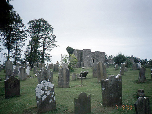 graveyard/cemeterygraveyard/cemetery · 15 yd
 church in ruinsChurch · 21 yd
 Ladys WellHoly well · 313 yd
 TyrrelstownWood · 832 yd
 MoatMound · 1110 yd
 Blanchardstown Centre information deskVisitor information · 1.2 mi
 Church, GraveyardChurch · 2.3 mi
 Site of CastleCastle, tower house · 2.3 mi
 Wesley's WoodsWood · 2.8 mi
 Castleknock CastleCastle · 3.0 mi
 Liam Ó MaoilíosaMemorial · 3.6 mi
 Griffeen Valley WalkWalking route · 5.0 mi
Other information
Photo: TeaTimeJ · CC BY-SA 4.0