What is recorded here
Half-buried in a hollow on the commonage between Gorteen and Lackwee, a low mass of lichen-crusted boulders hides the oval shadow of a dwelling. Its curving wall still leans outward, dumping loose stone across the grass like a broken ribcage, while a thin strip of bare earth marks the floor where someone once sat. The view stretches unbroken to the southwestern sea, suggesting the builder chose the exact spot where the land ends and the horizon begins.
Situated in a small hollow at the south-eastern foot of a low boulder-strewn hummock on the commonage midway between Gorteen and Lackwee. The site affords wide views of the coastline to SW. An amorphous, cairn-like mass (H 0.4m) of large, lichen-covered angular stones and boulders (8m N–S, 6.9m E–W, externally) marks the site of a possible dwelling.
Within the stone mass a roughly oval patch of grassy sward is discernible, possibly representing the stone-filled interior of a hut, roughly oval in plan (c. 2.4m N–S, 1.9m E–W). Traces of a curving revetment of stone protrude from the sod at SE and are traceable through S to SW as a line of curving slabs and boulders set on edge (three stones in all). No definite internal facing is traceable elsewhere, but there are traces of a possible external kerb from NE to ENE, where two set slabs, one very large (set on edge) protrude slightly from the sod. A number of quartz-veined, weathered boulders at the southern limits of the cairn may mark the continuation of this kerbing from SSE to S, particularly a very large boulder at the south-south-eastern corner.
Directly outside these boulders is a spread of stone, possibly collapse from the wall, which is traceable to S for a distance of 3m. Furthermore, to E of the main cairn is another spread of loose stone. Although less dense, it is traceable for 3m as a scatter of boulders and stones protruding from the sod: it peters out around a large, tall, thin set slab (L 1m, Wth 0.2m, H 0.7m).
An isolated length of wall (part of MA084-001001-) runs off from NW side of the hut on a NW axis for 3m almost to top of the hummock before turning northwards to take up a N–S axis. It can be traced N for a further c. 20m before it peters out on the summit of another small hummock.
The above description is derived from: New Survey of Clare Island. Volume 5: Archaeology. Edited by Paul Gosling, Conleth Manning and John Waddell. (Royal Irish Academy, Dublin. 2007). In certain instances the entries have been revised and updated.
Date of upload: 29 November 2018
The monument record does not grant public access. Check the route and ask the landowner before entering private land.
- What survives
- Recorded monument
Places near here
 Enclosure in BunnamohaunEnclosure · 204 yd
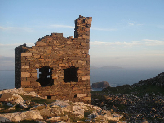 Shivel Head Signal Towersignal tower · 1014 yd
 Clare Island Signal TowerRuins · 1015 yd
 farm housefarm house · 1110 yd
 KnockmoreMountain / peak · 1.4 mi
 Clare IslandIsland · 2.1 mi
 ScalpatruceMountain / peak · 2.2 mi
 Granuaile's CastleCastle · 3.8 mi
 Caher IslandIsland · 5.2 mi
 Turloughbeg StrandBeach / strand · 6.1 mi
 Carrownisky BeachBeach / strand · 6.6 mi
 Kildavnet CastleCastle, tower house · 7.3 mi