What is recorded here
Situated on poorly drained, partially reclaimed rushy pasture, that was formerly the floodplain of the Camoge River. This stream flows from N to S immediately to the E. A post-1700 linear drainage channel to W is visible as a cropmark on aerial photographs and on the revised edition of the OS 6-inch map. One of five mounds recorded as feature G01F003 in 2012 LiDAR Survey (Motherway 2012, 276). Four mounds or possible barrows (LI022-258-/59-/60-/61) are visible on OSi orthophotos taken 2005-12. On this aerial photograph the three possible barrows are roughly aligned on a NW-SE axis
Earthwork visible on OSi aerial photographs taken 2005-2012, present remains consist of a low circular-shaped mound E of a post-1700 field drainage ditch. Original watercourse of the Camoge River can be seen closer to the possible barrows on OSi aerial photographs 2005-2012. This possible barrow is not visible today on Digital Globe orthophotos taken 2011-2013.
See attached LiDAR plot showing location of 5 mounds and OSi aerial orthophotos showing location of 3 possible barrows.
Compiled by: Caimin O'Brien based on details provided by Sarah McCutcheon and Ella Motherway
Date of upload: 29 April 2020
The monument record does not grant public access. Check the route and ask the landowner before entering private land.
- What survives
- Recorded monument
Places near here
 BarrowBarrow, mound barrow · 30 yd
 Cashelmongan, HachuredEnclosure · 636 yd
 Bawn in SkoolhillBawn · 936 yd
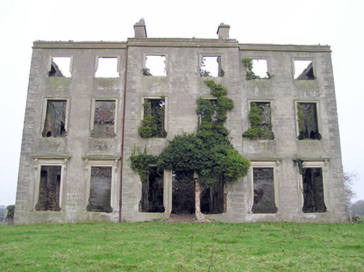 The Grangecountry house · 1001 yd
 Banoge's WellSpring · 1193 yd
 Sixmile Bridgebridge · 1268 yd
 Skool HillMountain / peak · 1336 yd
 Rockstown Castle (in ruins)Castle, tower house · 1.6 mi
 Carnane RockNamed rock · 2.2 mi
 The SpectaclesVisitor information · 2.3 mi
 Lough GurVisitor information · 2.3 mi
 Grange Stone CircleArchaeological place · 2.3 mi