What is recorded here
Fairy forts are human places misnamed, and Ballintry is no exception: a true ringfort, not a palace for invisible creatures. It stood beside the Pinkeen River in County Meath, a grass-covered circle wide enough for houses, yards and the ordinary noise of life. People built it, lived there, left it changed by weather and time, and forgot the names of everyone it held. The fairies entered later, filling the gap where memory failed.
Situated on a level landscape with a N-S section of the Pinkeen River c. 75m to the W. This was described in 1969 (SMR file) as a slightly raised and grass-covered circular area (diam. 42m NW-SE; 39m NE-SW) defined by an earthen bank (at SE: Wth of base 5.2m; int. H 0.2m; ext. H 1.2m; at NW: Wth of base 9m; int. H 0.9m; ext. H 1.9m), with an external fosse ENE-SE and NW-N (at NW: Wth 2.2m; ext. D 0.3m). There were modern gaps at SW and N but the original entrance (Wth 2m) was at E. Its visible profile had been removed by 1995 (OSAP).
The above description is derived from the published 'Archaeological Inventory of County Meath' (Dublin: Stationery Office, 1987). In certain instances the entries have been revised and updated in the light of recent research.
Compiled by: Michael Moore
Date of upload: 10 July 2007
Amended: 5 November 2021
The monument record does not grant public access. Check the route and ask the landowner before entering private land.
- What survives
- Recorded monument
Places near here
 Enclosure in CalliaghweeEnclosure · 550 yd
 Enclosure in BallintryEnclosure · 1099 yd
 Wesley's WoodsWood · 1.0 mi
 Caulstown Christmas Tree FarmForest · 1.3 mi
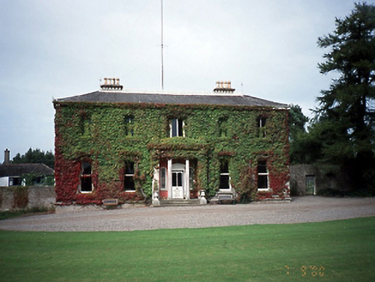 Tyrrelstown Housecountry house · 1.7 mi
 Saint Thomas's Church (Mulhuddart)church/chapel · 1.8 mi
 Kilbride MoatCastle, motte · 1.8 mi
 Graveyard in BuzzardstownGraveyard · 2.1 mi
 Blanchardstown Centre information deskVisitor information · 3.2 mi
 Depicted Kilshane MoatCastle, motte · 3.4 mi
 Church, GraveyardChurch · 3.5 mi
 Wooly Ward's FarmHeritage attraction · 5.8 mi