
What is recorded here
Thirty metres of grass and shadow remain where a fort once stood, its broken ring marked still by a tree-lined ditch and a straight drain cutting through the west. The 1840 survey called it one of four forts in Ballingarry, but ploughs and pond water have since sanded the edges into pasture. It sits eighty metres from a holy well and old graveyard, as if the living field and dead field still share one breath.
In pasture, immediately S of a road running E-W that forms townland boundary with Ballyfroota. A megalithic structure (LI049-103----), graveyard (LI049-102---) and holy well (LI049-101----) lie 80m to the NW. Depicted on the 1840 ed. OSi 6-inch map as a raised circular-shaped area defined by a scarp with a stone wall on top. Shown on the 1897 ed. OSi 25-inch map as a raised sub-circular shaped area (dims. c. 66m N-S; 58m E-W) defined by a scarp from NW-N-E-S-SW, truncated at W by a drain running NE-SW, intersected at NE by a pond. In 1840 the Ordnance Survey recorded this monument as one of 'four forts' in the townland (OSNB Abbeyfeale to Bruree, 191). Partially levelled monument visible as sub-circular shaped area defined by a tree-lined fosse from NW-N-E-S-SW on Digital Globe orthoimage taken between 2011-13 and on Google Earth orthoimages. A linear cropmark running NE-SW, truncating the monument at W is visible on Google Earth orthoimage taken 10/10/2006.
See attached Google Earth orthoimages.
Compiled by: Fiona Rooney
Date of upload: 11 October 2021
The monument record does not grant public access. Check the route and ask the landowner before entering private land.
- What survives
- Recorded monument
Places near here
 Megalithic structure in BallyfrootaMegalithic structure · 140 yd
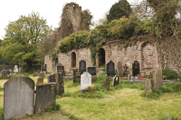 Grave YardBurial ground · 168 yd
 bridgebridge · 723 yd
 Saint Patrick's Catholic Churchchurch/chapel · 959 yd
 SlievereaghMountain / peak · 1.3 mi
 Saint Patrick's WellSpring · 1.6 mi
 Duntryleague - hachuredCastle, ringwork · 1.8 mi
 Edmund's WellSpring · 2.0 mi
 Ryves CastleCastle, unclassified · 2.3 mi
 Ballinvreena LoopVisitor information · 2.5 mi
 Darby's Bed Walk LoopWalking route · 2.7 mi
 Duntryleague HillMountain / peak · 2.7 mi
Other information
Photo: Credit not shown in the picture search · Rights wording not checked; contact us if this picture should be removed