What is recorded here
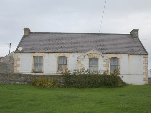
Detached four-bay single-storey house, built c. 1880, having projecting gable-fronted porch, and single-storey extension to rear (north-east). Pitched natural slate roof with thin cement copings to gable ends (north-west and south-east), corbelled chimneystacks to gable ends (yellow brick to north-west gable and cement rendered to south-east gable), and with remnant cast-iron rainwater goods. Possibly original a schoolmaster's house, now unoccupied. Painted smooth rendered lined-and-ruled rendered walls to front elevation (south-west), porch and south-east gable having raised smooth rendered block-and-start quoins and smooth rendered sill course; painted roughcast rendered walls to the north-west gable end to other gable. Segmental-headed window openings with painted sills, decorative smooth render surrounds, and with two-over-two pane horned timber sliding sash windows; smooth rendered hoodmoulding over window opening to porch having decorative label stops. Square-headed door opening to south-east elevation of projecting porch with battened timber door. Set back from road in own grounds to the south of Malin Head. Bounded on road-frontage to the south-west by rendered rubble stone wall; yard to rear with two attached outbuildings.
This simple but attractive single-storey house, dating to the last decades of the nineteenth century, retains its original form and character despite being no longer occupied. Its visual expression and integrity is enhanced by the retention of salient fabric such as the natural slate roof and the timber sliding sash windows. The front elevation is enlivened by the simple render quoins to the corners, the sill course, and the surrounds to the openings. This building is constructed to vernacular proportions but with a level of decorative detailing that would suggest a formal design. It is built on the site of a school marked on the Ordnance Survey first edition six-inch map sheet of c. 1837. Its design suggests that it may have been built as a dwelling for a local official, perhaps a schoolmaster at a school that formerly lay to the south-east, now demolished and replaced by a later building, dated 1940 (not in survey). Sensitively restored, this building would make a positive contribution to its pleasant rural location to the south of Malin Head.
This does not grant access. Most recorded buildings are privately owned; view them only from public ground unless the owner allows entry.
Places near here
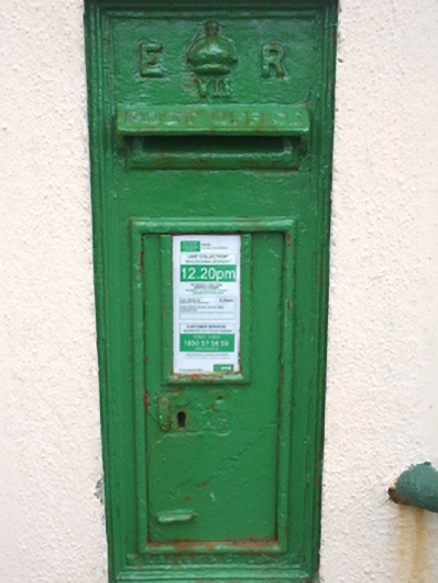 post boxpost box · 161 yd
 Wee House of Malin CaveCave · 1441 yd
 Malin Well Old ChurchChurch · 1469 yd
 The Doon at Malin WellPromontory fort, coastal · 1514 yd
 Malin WellHoly well · 1702 yd
 Pebble StrandBeach / strand · 1.6 mi
 EIRE 80 signSecond World War neutrality sign · 2.0 mi
 Malin HeadHeritage attraction · 2.0 mi
 Wild Atlantic Way:Malin HeadVisitor information · 2.0 mi
 Hell's Hole Cavern, Malin HeadSea cavern and cliff chasm · 2.4 mi
 Devil's Bridge, Malin HeadNatural rock arch · 2.5 mi
 SkildrenbegIslet · 2.6 mi
Other information
Photo: National Inventory of Architectural Heritage · Website use allowed for educational or private purposes with source credit