What is recorded here
Indicated is a hilltop enclosure in County Cork where an earthen bank and stone boundary still trap a semicircle of land above Cork Harbour. The field is locally called the fort field, a name that suggests people once valued its command of the water and sky. Trees still stand among uneven, waterlogged ground, marking the place as both remembered and half-forgetting itself.
In pasture, commanding extensive view to NE across Cork Harbour. Irregular area (c. 70m N-S; c. 35m E-W) defined by earthen bank (max. ext. H 2m) S->SE; stone faced field boundary to SSE. Enclosure at N end, forms semicircle, enclosing top of hill. Interior originally planted with trees (1934 OS 6-inch map), some remain; surface uneven and waterlogged, with depressions due to removal of tree roots. Field locally known as ' the fort field' (pers. comm. D. Ó Murchadha).
The above description is derived from the published 'Archaeological Inventory of County Cork. Volume 2: East and South Cork' (Dublin: Stationery Office, 1994). In certain instances the entries have been revised and updated in the light of recent research.
Date of upload/revision: 14 January 2009
The monument record does not grant public access. Check the route and ask the landowner before entering private land.
- What survives
- Recorded monument
Places near here
 Castle (in Ruins)Castle, tower house · 671 yd
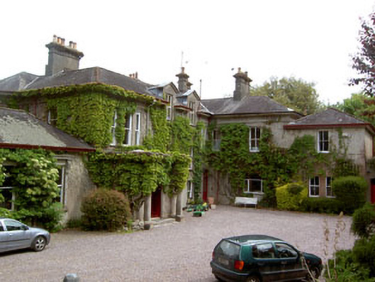 Aghamarta Castlecountry house · 757 yd
 Church in HoddersfieldChurch · 815 yd
 Man-made underground passage in Killeen (kerrycurrihy By.)Man-made underground passage · 860 yd
 Coolmore WoodWood · 1419 yd
 Fulacht fia in Brownstown (kerrycurrihy By.)Fulacht fia · 1582 yd
 Loughbeg Bird ReserveNature reserve · 1.6 mi
 Fountainstown BeachBeach / strand · 1.8 mi
 Crosshaven Tourist OfficeVisitor information · 1.9 mi
 William Warren Baldwin plaqueMemorial · 1.9 mi
 Myrtleville BeachBeach / strand · 2.0 mi
 The Giant's GraveMonument · 2.0 mi