What is recorded here
Places near here
Picture notes
- Computer-made picture. It does not show this monument.
- Bob Jones, Geograph · CC BY-SA 2.0
- Paul McIlroy, Geograph · CC BY-SA 2.0
- Copernicus Sentinel-2, ESA, Wikimedia Commons · CC BY-SA 3.0 igo
- Computer-made picture. It does not show this mountain top.
- Donald MacDonald, Wikimedia Commons · CC BY-SA 2.0
- Computer-made picture. It does not show this playground.
- Anne Burgess, Wikimedia Commons · CC BY-SA 2.0
- Computer-made picture. It does not show this walking route.
- Eric Jones, Geograph · CC BY-SA 2.0
 Boat shelters (2) in Ballygill SouthBoat shelters (2) · 137 ydComputer-made picture
Explorer Tom Boat shelters (2) in Ballygill South ended up in the wrong place because someone misread the map and parked them inland. Eighteenth or nineteenth century, so they’ve been sitting there looking confused for a while. Perfect detour when the satnav has a meltdown.
 StroanleaHeadland · 230 yd
Explorer Tom Stroanlea is a headland in County Antrim, best viewed from the permissive path that follows the cliff edge.
 Possible prehistoric occupation site in Kinramer SouthPossible Prehistoric Occupation Site · 618 ydComputer-made picture
Explorer Tom Possible prehistoric occupation site in Kinramer South is basically a giant's leftover lunch tray. No stones, just vibes and ancient footprints. Bring your own legend, I've run out of good ones.
 SroanderrigHeadland · 969 yd
Explorer Tom Sroanderrig Point offers views towards Rathlin and Fair Head, connecting this headland to other dramatic features along the coast.
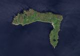 Rathlin IslandIsland · 1535 yd
Explorer Tom Rathlin Island captures true color from space, showing off its rugged charm in County Antrim waters.
 SlieveacarnMountain / peak · 1.0 miComputer-made picture
Explorer Tom Slieveacarn is just a mountain record for now, but it surely has its own quiet charm in County Antrim.
 Rathlin West LighthouseLighthouse · 1.5 mi
Explorer Tom Rathlin West Lighthouse stands firm in County Antrim, likely keeping a steady watch over the waves for anyone passing by safely.
 SlieveardMountain / peak · 1.6 miComputer-made picture
Explorer Tom Slieveard is just a name on the map, but surely it has some lovely views to offer in County Antrim.
 Children's playground2.1 miComputer-made picture
Explorer Tom This unnamed area in County Antrim is likely where local children gather to burn off energy and have fun together.
 Boat House2.1 mi
Explorer Tom Boat House in Boat House The Station Rathlin Island is a unique Grade B1 find. This charming structure has likely hosted many boats and stories over the years.
 Ballyconaghan Circular Trail, RathlinWalking route · 2.2 miComputer-made picture
Explorer Tom The Ballyconaghan Circular takes you over National Trust land for stunning Atlantic views. You might even spot Scotland!
 Ballycarry Trail, RathlinWalking route · 2.8 mi
Explorer Tom Curious about Rathlin’s Ballycarry Trail? With new dwellings popping up nearby, it feels like a place constantly waking up.
More wrecks and historic events in County Antrim · All of County Antrim

What do you know about this place?Tap to add a comment or ask a question