What is recorded here
Situated on a natural hillock in undulating terrain. The Royal Visitation of 1615 described the building as a 'church and chancell downe' (Murphy 1914, 222). A poorly preserved church (int. dims. 6.7m N-S; 16.4m E-W; wall T 0.75m) constructed of roughly coursed irregular blocks of sandstone and limestone rubble. Only the N wall stands to any substantial height - the three remaining walls are in poor condition, the S and E walls being mainly rubble. A gap roughly in the centre of the S wall with a large slab lying recumbent may be the entrance although it is possibly too far to the E. The wall including the foundation was removed at the S end of the E wall to provide space for the stepped concrete base of a large modern crucifix. A graveyard clean-up has been carried out here in recent years. A pile of stones is dumped in the interior against the N wall and a high heap of rubbish has been dumped up against the external face of the N wall.This wall has no visible features and is partly obscured by ivy. The fragment of a jamb surviving with stonework suggests a fifteenth-century date for the church. Only the foundations of a possible external porch (dims. 2.75m x 2.2m) remain as a grass-covered bank (Wth 1.15m) at the W end of the S wall. There is no visible gap in the S wall at this point, however, the wall is very rubbly and is likely to have been built up. The OS Letters mention that 'there was a lateral apartment or sacristy off this Church at the north east corner; a part of its north wall still remains' and gives rough dimensions as 7.2m x 3.85m (O'Flanagan 1930, vol. 2, 79). The graveyard (TN017-042003) extends downslope from the church towards the S and is enclosed by a hexagonal stone wall. It was enclosed by an earlier bank/collapsed wall (TN017-042001) which is particularly apparent SW, W and NE of the church (Wth 1.4m; int. H 0.26m; ext. H 1.06m) but peters out to the SE and E. N of the church, outside the later stone wall there is a ramp (Wth c. 6m; L c. 30m; avg. H 0.7m) which appears to be running up to the enclosure and may represent an earlier entrance feature. The townland name has been interpreted as the Rath of St Mobheog (Stout 1984, 90).
The above description is derived from 'The Archaeological Inventory of County Tipperary. Vol. 1 - North Tipperary' compiled by Jean Farrelly and Caimin O'Brien (Dublin: Stationery Office, 2002). In certain instances the entries have been revised and updated in the light of recent research.
Date of upload/revision: 22 September 2008
Rathnaveoge Church was likely built in the early 17th century, with its ruins and graveyard reflecting a medieval ecclesiastical tradition. The structure, described as a church and chancel in 1615, is significant as a historical example of early Irish church architecture in a rural setting.
The monument record does not grant public access. Check the route and ask the landowner before entering private land.
- What survives
- Recorded monument
Places near here
 Grave YardEcclesiastical enclosure · 16 yd
 Castle (in ruins)Castle, tower house · 851 yd
 Enclosure in CastleroanEnclosure · 1440 yd
 Hollywell Millmill (water) · 1587 yd
 OutlinedCastle, Anglo-Norman masonry castle · 1.1 mi
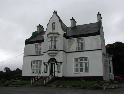 The Rectoryrectory/glebe/vicarage/curate's house · 1.3 mi
 Longford WoodForest · 1.7 mi
 BenduffMountain / peak · 3.1 mi
 Borrisnoe MountainMountain / peak · 4.1 mi
 White MulberryWhite Mulberry · 4.5 mi
 Roscrea Petty Sessions HouseHeritage attraction · 5.1 mi
 Millennium GardenMemorial · 6.1 mi