
What is recorded here
Map note: Find the recorded point for Rathmarrick, an ancient site in County Mayo, Ireland. There is no need to invent a lost kingdom to make the name interesting.
Rathmarrick is recorded as an archaeological place in County Mayo.
From OpenStreetMap (© OpenStreetMap contributors) w1285241383
Places near here
Photo credits
- Kay Atherton, Geograph · Creative Commons Attribution-ShareAlike 2.0
- National Inventory of Architectural Heritage
- Neville Goodman, Geograph · Creative Commons Attribution-ShareAlike 2.0
- Pamela Norrington, Geograph · CC BY-SA 2.0
- Ray Martin, Wikimedia Commons · Public domain
- Mike Searle, Wikimedia Commons · CC BY-SA 2.0
- Liz McCabe, Wikimedia Commons · CC BY-SA 2.0
- jeremy durrance, Geograph · Creative Commons Attribution-ShareAlike 2.0
- Liz McCabe, Geograph · CC BY-SA 2.0
 Enniscoe HouseWalled garden · 624 yd
Explorer Tom Enniscoe House walled garden has a long grudge against the weather for ruining its plans. The walls stand firm while the flowers give up every spring. Snap one photo, then run before it complains more.
Castle IslandIslet · 1.1 mi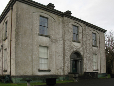 Castlehill HouseFarm house · 1.3 mi
Explorer Tom Castlehill House in Castlehill would bring its own gossip and a very fancy hat to any party. It was rebuilt for a man who clearly thought he was better than everyone else. Tell me if the gossip I made up is true or not.
Roe IslandIslet · 1.4 miGrave of the KingsArchaeological place · 2.0 mi Graveyard2.3 mi
 Titanic Memorial ParkMemorial · 2.4 mi
 CastleCastle, tower house · 3.9 mi
 Deel CastleCastle · 4.1 mi
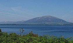 NephinMountain / peak · 4.2 mi
 IndicatedFairy fort / earthen ringfort · 6.8 mi
 FarbreigaMountain / peak · 7.2 mi
More archaeology and monuments in County Mayo · All of County Mayo

What do you know about this place?Tap to add a comment or ask a question