
What is recorded here
From the Northern Ireland Sites and Monuments Record record TYR060:001
Places near here
Photo credits
- Kenneth Allen, Wikimedia Commons · CC BY-SA 2.0
- Maker not stated on source page, commons.wikimedia.org
- Kenneth Allen, Geograph · CC BY-SA 2.0
- Maker not stated on source page, www.tripadvisor.ie
- Maker not stated on source page, www.pinterest.com
- National Inventory of Architectural Heritage
- Maker not stated on source page, www.dreamstime.com
- Maker not stated on source page, www.alamy.com
- We Are Tyrone; individual photographer not named on the article, wearetyrone.com
 Ballymagrane Presbyterian ChurchChurch · 1.5 mi
Explorer Tom Ballymagrane Presbyterian Church in County Tyrone handles nosey neighbours by just turning its back and pretending it’s…
 Mapped cemeteryCemetery · 1.8 mi
Explorer Tom Mapped cemetery in County Tyrone is playing hard to get on its dating profile, claiming it’s ‘too mysterious’ and…
 Medieval Parish Church; Graveyard also Site of C13th Battle: Carnteel Church in CarnteelMedieval Parish Church · 1.8 mi
Explorer Tom Medieval Parish Church, Graveyard also Site of C13th Battle: Carnteel Church in Carnteel was saved by a hero so…
 Court tomb: horned cairn in GlasdrummondCourt Tomb: Horned Cairn · 1.8 mi
Explorer Tom Court tomb: horned cairn in Glasdrummond survived a storm so bad it threw its own stones into the next county. It’s…
 Minterburn Presbyterian ChurchChurch · 1.9 mi
Explorer Tom Minterburn Presbyterian Church in Lismulladown has been waiting for a prophecy that said it’d fly away by now, but it’s…
 Fairy fort / earthen ringfort in Mullanacross (trough By.)Fairy fort / earthen ringfort · 3.7 mi
Explorer Tom Fairy fort / earthen ringfort in Mullanacross hosted a dance that went so far they forgot how to walk home. It’s tucked…
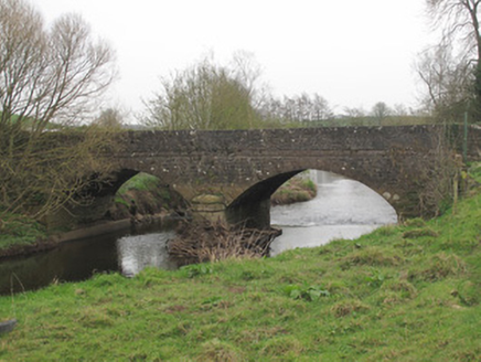 Ravellea BridgeBridge · 3.8 mi
Explorer Tom Ravellea Bridge is standing there on the Blackwater, looking smug because it survived the nineteenth century without a…
 Fairy fort / earthen ringfort in MullanafinnogFairy fort / earthen ringfort · 4.6 mi
Explorer Tom Fairy fort / earthen ringfort in Mullanafinnog hears seagulls gossiping about it every single morning, even though…
 Fairy fort / earthen ringfort in Killyleck (anketell)Fairy fort / earthen ringfort · 4.6 mi
Explorer Tom Fairy fort / earthen ringfort in Killyleck has a fan club of seagulls who gossip about how flat and unimpressive it…
 Mapped graveyardGraveyard · 4.6 mi
Explorer Tom this Mapped graveyard in County Monaghan has a scandal it’s been hiding for centuries involving a goat, a bishop, and a…
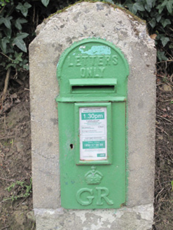 post box4.6 mi
Explorer Tom The post box in Tavanagh is being held hostage by one very stubborn bird who refuses to leave. It has George V’s face…
 Fr. Connolly Park, St. Patrick's GAA, EglishGAA ground · 5.2 mi
More archaeology and monuments in County Tyrone · All of County Tyrone

What do you know about this place?Tap to add a comment or ask a question