
What is recorded here
From the Northern Ireland Sites and Monuments Record record TYR037:005
Places near here
Photo credits
- Maker not stated on source page, www.pinterest.com
- Maker not stated on source page, ru.pinterest.com
- Maker not stated on source page, ca.pinterest.com
- Kenneth Allen / Geograph Britain and Ireland, www.geograph.org.uk
- Kenneth Allen, Geograph · CC BY-SA 2.0
- Maker not stated on source page, www.dreamstime.com
- Rock St Patrick’s GFC official club website; individual photographer not stated, www.rockstpatricksgac.co.uk
- Kenneth Allen, Wikimedia Commons · CC BY-SA 2.0
- Linda Bailey, Geograph · CC BY-SA 2.0
- Linda Bailey, Wikimedia Commons · CC BY-SA 2.0
 Nine Stone Circles & Two Alignments: Moymore Stone Circles in MoymoreNine Stone Circles & Two Alignments: Moymore Stone Circles · 926 yd
Explorer Tom Nine Stone Circles & Two Alignments: Moymore Stone Circles are being claimed by a local who says he invented the…
 Megalithic tomb in MoymoreMegalithic Tomb · 968 yd
Explorer Tom Megalithic tomb in Moymore is guarded by a shortcut that isn't actually a shortcut, leading you through three fields…
 Killeen & possible megalithic tomb: shanrelick in KeenaghanKilleen & possible Megalithic Tomb: Shanrelick · 1005 yd
Explorer Tom Killeen & possible megalithic tomb: shanrelick in Keenaghan is a mix of modern and ancient nonsense. The builder was…
 Cairn: carnan hill in Carnenny; GortindarraghCairn: Carnan Hill · 1.1 mi
Explorer Tom Cairn: carnan hill in Carnenny has an imaginary twin across the sea who is currently winning at life. It's jealous…
 Plunkett Park, Plunkett's GAA, PomeroyGAA ground · 2.1 mi
 Standing stone: druids' altar in GortreaghStanding Stone: Druids' Altar · 2.3 mi
Explorer Tom Standing stone: druids' altar in Gortreagh would absolutely nail a job interview if it could talk. It would walk right…
 Multiperiod Church & Graveyard: Magheraglass; Magheryfinglass; Magh-eitir-di-glais in MagheraglassMultiperiod Church & Graveyard: Magheraglass · 2.4 mi
Explorer Tom Multiperiod Church & Graveyard: Magheraglass; Magheryfinglass; Magh-eitir-di-glais in Magheraglass has a lifelong feud…
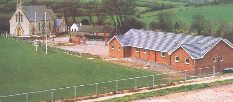 Páirc Naomh Pádraig, St. Patrick's GAA, RockGAA ground · 2.5 mi
 Drum Manor Forest ParkWood · 3.5 mi
Explorer Tom Drum Manor Forest Park near Cookstown gives you woodland paths, a wildfowl lake and the ruins of a manor house, as if…
 Medieval & post-med. church & graveyard: kildress church in Kildress UpperMedieval & Post-med. Church & Graveyard: Kildress Church · 4.1 mi
Explorer Tom Medieval & post-med. church & graveyard: Kildress church in Kildress Upper had a fiddler play there all night until the…
 Kildress Old ChurchRuins · 4.1 mi
Explorer Tom Kildress Old Church in County Tyrone sounds like 'Kill Dress,' which I think means it eats your fashion sense if you…
 Sandholes Presbyterian ChurchChurch · 4.5 mi
Explorer Tom Sandholes Presbyterian Church in Skenarget is built on top of actual sand dunes, which makes it feel like it's slowly…
More archaeology and monuments in County Tyrone · All of County Tyrone

What do you know about this place?Tap to add a comment or ask a question