
What is recorded here
From the Northern Ireland Sites and Monuments Record record TYR016:047
Places near here
Photo credits
- Maker not stated on source page, tr.pinterest.com
- Maker not stated on source page, commons.wikimedia.org
- Kenneth Allen, Wikimedia Commons · CC BY-SA 2.0
- Maker not stated on source page, www.flickr.com
- Kenneth Allen, Geograph · CC BY-SA 2.0
- Maker not stated on source page, au.pinterest.com
- Maker not stated on source page, en.wikipedia.org
- Maker not stated on source page, www.pinterest.com
- National Inventory of Architectural Heritage
 Megalithic tomb: giant's den in MeaghyMegalithic Tomb: Giant's Den · 224 yd
Explorer Tom Megalithic tomb: giant's den in Meaghy is hosting its own secret fan club. Apparently, every time someone whispers a…
 Mapped graveyardGraveyard · 1647 yd
Explorer Tom This mapped graveyard in County Tyrone has been hiding a scandal for centuries involving a local politician who lost…
 Two standing stones in Crew LowerTwo Standing Stones · 1.0 mi
Explorer Tom Two standing stones in Crew Lower have very strong opinions on the road that leads to them, mostly because it’s too…
 Church & Graveyard: Gervaghkerin, Gervagh-kerin, Garvaghkeirinn or Scairb An Ciothrainn in ScavagherinChurch & Graveyard: Gervaghkerin, Gervagh-kerin, Garvaghkeirinn or Scairb An Ciothrainn · 1.5 mi
Explorer Tom Church & Graveyard: Gervaghkerin has four different names, which means it’s either very popular or just really confused…
 Standing stone in KilleenStanding Stone · 1.5 mi
Explorer Tom Standing stone in Killeen is two and a half metres tall and standing right by the hedge like a sentry. If it won the…
 Standing stone (site of) in KilleenStanding stone (site of) · 1.9 mi
Explorer Tom Standing stone in Killeen is the site of a hidden treasure that is definitely a biscuit tin. The legend says if you…
 Ring cairn in CarnkennyRing Cairn · 2.0 mi
Explorer Tom Ring cairn in Carnkenny was saved by a hero nobody remembers who probably just wanted to clear a path for his cows.…
 Ardstraw BridgeBridge · 2.2 mi
Explorer Tom Ardstraw Bridge in County Tyrone was skipped by a bishop in 1725 because he thought it looked 'too much like a foot,'…
 Pre-norman & Medieval Church (site of) & Graveyard: Ard Sratha, Ardstraw in ArdstrawPre-norman & Medieval Church (site of) & Graveyard: Ard Sratha, Ardstraw · 2.2 mi
Explorer Tom Pre-norman & Medieval Church & Graveyard: Ard Sratha, Ardstraw in Ardstraw had a priest who wrote such bad poetry that…
 Fearn HillMountain / peak · 4.2 mi
Explorer Tom Fearn Hill sits in County Donegal with its access details completely unknown to the mapmakers. The only clue is a…
 Castle and bawn in SeeinCastle and Bawn · 4.8 mi
Explorer Tom Castle and bawn in Seein is picking on the wind because the wind won't stop blowing its roof tiles off one by one. It’s…
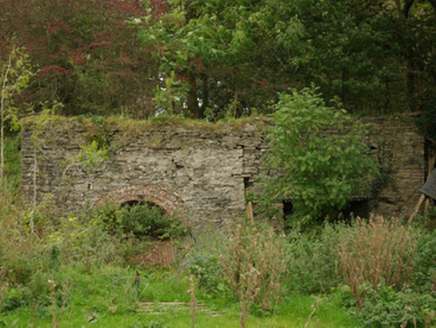 kiln5.8 mi
Explorer Tom Kiln in Alt Lower has a segmental-headed opening that was used to fire the stone. I bet you had to shout 'hot potato'…
More archaeology and monuments in County Tyrone · All of County Tyrone

What do you know about this place?Tap to add a comment or ask a question