
What is recorded here
From the Northern Ireland Sites and Monuments Record record LDY018:017
Places near here
Photo credits
- Maker not stated on source page, www.wikidata.org
- Bjmullan / Wikimedia Commons, commons.wikimedia.org
- Maker not stated on source page, www.pinterest.com
- Maker not stated on source page, www.flickr.com
- Maker not stated on source page, www.forestresearch.gov.uk
- Maker not stated on source page, commons.wikimedia.org
- Maker not stated on source page, www.tripadvisor.in
- Maker not stated on source page, www.dreamstime.com
- R.D Photography (watermark); photograph published by Glenullin GAC on its own fundraising page, www.crowdfunder.co.uk
- Richard Webb, Geograph · CC BY-SA 2.0
- Cormac Duffin, Geograph · CC BY-SA 2.0
 Holy well: tobar goura in CrockindollaghHoly Well: Tobar Goura · 211 yd
Explorer Tom Holy well: Tobar Goura in Crockindollagh sits between two families who have been arguing over who owns the view for…
 Shamrock Park, Sarsfield's GAA, BallerinGAA ground · 973 yd
 Holy well: toberteefrim in BoleranHoly Well: Toberteefrim · 1177 yd
Explorer Tom Holy well: toberteefrim in Boleran sounds like a word you'd invent at the pub after three pints. Its least favourite…
 Aghadowey Forest - Scotch Cah (Public Access)Forest · 1.1 mi
Explorer Tom Scotch Cah would tell the interviewer it has strong references and a very solid track record of standing still for…
 Cist (O.S. memoir site, unlocated) in TamnymoreCist (O.S. memoir site, unlocated) · 1.6 mi
Explorer Tom Cist (O.S. memoir site, Unlocated) in Tamnymore is unlocated because the map makers were hungover and decided…
 Aghadowey Forest - Ballynacally Beg (Public access)Forest · 1.7 mi
Explorer Tom Ballynacally Beg would cope on a reality show by refusing to change its outfit and ignoring every single camera lens in…
 Standing stone (removed) in TamnymoreStanding stone (removed) · 1.8 mi
Explorer Tom Standing stone (removed) in Tamnymore is the world's most dramatic ghost, gone before anyone even wrote a review. It…
 Standing stone: the grey stone (unlocated) in Mettican GlebeStanding stone: the grey stone (unlocated) · 1.8 mi
Explorer Tom Standing stone: the grey stone in Mettican Glebe has inspired at least one terrible poem about its majestic greyness…
 Graveyard & Man-made underground passage: nicholl's ground in KiltestGraveyard & Man-made underground passage: nicholl's ground · 2.5 mi
Explorer Tom Nicholl's Ground in Kiltest has an underground passage that’s been around since Early Christian times. It’s scheduled…
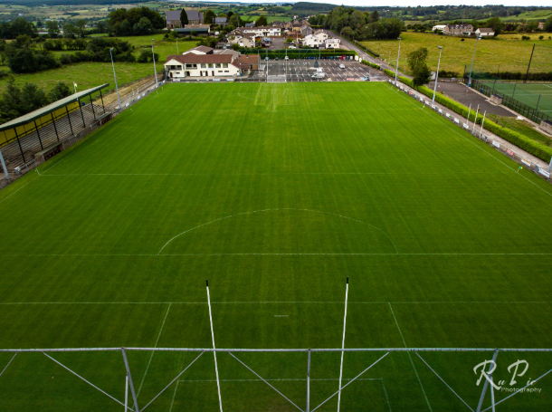 Páirc Sheáin Uí Mhaoláin, John Mitchel's GAA, GlenullinGAA ground · 4.4 mi
 Donald's HillMountain / peak · 4.8 mi
Explorer Tom Donald's Hill in County Derry has a bird that refuses to leave no matter how bad the weather gets or how rude the…
 Legananam PotCliff · 6.1 mi
Explorer Tom Legananam Pot in County Derry isn't actually a pot but a glacial meltwater channel, which is a bit of a letdown for…
More archaeology and monuments in County Derry · All of County Derry

What do you know about this place?Tap to add a comment or ask a question