
What is recorded here
From the Northern Ireland Sites and Monuments Record record TYR023:012
Places near here
Photo credits
- Maker not stated on source page, en.wikipedia.org
- Maker not stated on source page, de.wikipedia.org
- Maker not stated on source page, uk.pinterest.com
- Richard Webb, Wikimedia Commons · CC BY-SA 2.0
- Castlederg St Eugene’s GAA official club site; aerial photographer unnamed, castlederggaa.weebly.com
- Kenneth Allen, Wikimedia Commons · CC BY-SA 2.0
- Maker not stated on source page, www.pinterest.com
- Richard Webb, Geograph · CC BY-SA 2.0
- Kenneth Allen, Geograph · CC BY-SA 2.0
 Standing stone in Killen FarStanding Stone · 1.1 mi
Explorer Tom Standing stone in Killen Far is deeply suspicious of the postman and watches him every single time he passes by. It’s…
 Portal tomb: druid's altar in LeitrimPortal Tomb: Druid's Altar · 1.3 mi
Explorer Tom Portal tomb: druid's altar in Leitrim was originally a dating spot for very serious, mossy-looking men. The matchmaker…
 Standing stone, possibly remains of Megalithic Tomb in MagheranageeraghStanding stone, possibly remains of Megalithic Tomb · 1.5 mi
Explorer Tom Standing stone in Magheranageeragh handles nosey neighbours by just standing there and looking unimpressed until they…
 Killeter BridgeBridge · 1.6 mi
Explorer Tom Killeter Bridge in Woodside/Magheranageeragh is stuck in a bitter feud with the family on the other side about who gets…
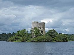 Castle: castle gore in CastlegoreCastle: Castle Gore · 1.7 mi
Explorer Tom Castle Gore in Castlegore would win the county fair just by standing there and letting everyone else do all the work.…
 Marius McHugh Park, St. Eugene's GAA, CastledergGAA ground · 2.3 mi
 Derg CastleCastle · 2.4 mi
Explorer Tom Derg Castle was basically built on a dare between two lads who bet they could out-build everyone else by the river. Now…
 St Patrick's rc ChurchChurch · 2.6 mi
Explorer Tom St Patrick's RC Church in Aghyaran is locked in a bitter, silent feud with the church three miles over because one of…
 Aghyaran GraveyardCemetery · 2.6 mi
Explorer Tom Aghyaran Graveyard in County Tyrone gave up eating chocolate for Lent, but only because the gulls kept stealing it off…
 Church; graveyard: cill chairill or kelkirell or kylchyrryll in MagherakeelChurch · 3.2 mi
Explorer Tom Church, graveyard: cill chairill or kelkirell or kylchyrryll in Magherakeel is claimed by a local who says he invented…
 Lismullyduff MountainMountain / peak · 5.8 mi
Explorer Tom Lismullyduff Mountain in County Donegal is having a drama with the nearest tree because it thinks the tree is stealing…
 Fearn HillMountain / peak · 5.9 mi
Explorer Tom Fearn Hill sits in County Donegal with its access details completely unknown to the mapmakers. The only clue is a…
More archaeology and monuments in County Tyrone · All of County Tyrone

What do you know about this place?Tap to add a comment or ask a question