
What is recorded here
From the Northern Ireland Sites and Monuments Record record DOW029:012
Places near here
Photo credits
- Maker not stated on source page, www.thenorthernantiquarian.org
- Eric Jones, Geograph · CC BY-SA 2.0
- Maker not stated on source page, monumentalireland.ie
- Kmcnamee, Wikimedia Commons · CC BY-SA 4.0
- Albert Bridge, Geograph · CC BY-SA 2.0
- HENRY CLARK, Geograph · CC BY-SA 2.0
- Maker not stated on source page, commons.wikimedia.org
- Brian Shaw, Wikimedia Commons · CC BY-SA 2.0
- Maker not stated on source page, www.pinterest.com
- Maker not stated on source page, irelandonabudget.com
 Cup-marked stone in BegnyCup-marked Stone · 876 yd
Explorer Tom Cup-marked stone in Begny is basically a prehistoric tattoo that got cold feet. Someone etched dots on it, probably to…
 Medieval parish church (site of) & graveyard: saint john's in DromaraMedieval Parish Church (site of) & Graveyard: Saint John's · 1328 yd
Explorer Tom Medieval Parish Church (site of) & GRAVEYARD: SAINT JOHN'S in Dromara is on Banbridge Road, swapping Catholic for…
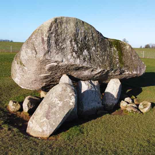 Folly: Replica portal tomb in MullaghdrinFolly: Replica portal tomb · 1.0 mi
Explorer Tom Folly: Replica portal tomb in Mullaghdrin is a modern fake pretending to be old, which is basically what every…
 Drinn Park, Dromara GAAGAA ground · 1.2 mi
 Darby's LoaninWalking route · 1.3 mi
Explorer Tom Darby's Loanin would spend its lotto win on better signposts, because right now it’s just a name. The tree-lined banks…
 Glen LoaninWalking route · 2.1 mi
Explorer Tom Glen Loanin in County Down is where the Vikings got hopelessly lost looking for it, wandering round in circles like…
 Drumkeeragh Forest ParkPark · 3.2 mi
Explorer Tom Drumkeeragh Forest Park in County Down would teach history class if forced, but it would mostly complain about how many…
 Slieve CroobMountain / peak · 3.2 mi
Explorer Tom Slieve Croob sends the River Lagan off toward Belfast, then stays in County Down to enjoy the view. At 534 metres it…
 Graveyard (unlocated) in GlasdrummanGraveyard (unlocated) · 3.5 mi
Explorer Tom Glasdrumman graveyard is unlocated, so the map makers clearly took a day off and guessed wrong. Medieval to…
 SlieveniskyMountain / peak · 3.9 mi
Explorer Tom Slievenisky is bragging about being four hundred and forty-six metres tall, which sounds impressive until you realise…
 Graveyard With Cross-inscribed Pillar Stone in LeganannyGraveyard With Cross-inscribed Pillar Stone · 4.6 mi
Explorer Tom Legananny graveyard has a cross-inscribed pillar stone that would write 'single, likes old stones' on its dating…
 Backaderry WoodForest · 4.8 mi
Explorer Tom Backaderry Wood is a piece of Drumkeeragh Forest in County Down, where the trees get the first word and the views make…
More archaeology and monuments in County Down · All of County Down

What do you know about this place?Tap to add a comment or ask a question