What is recorded here
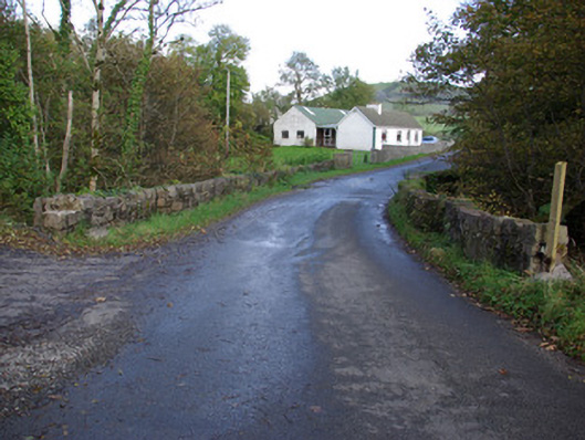
Single-arched bridge carrying road over the Ballintra River, built c. 1780. Round-headed arch having roughly squared rubble stone voussoirs and rubble stone masonry to arch barrel. Coursed and squared rubble stone construction with rubble stone construction to parapets with rubble stone coping; modern repairs in places. Rubble stone wing walls to either ends of parapets. Wing walls step-in on plan to centre. Tarmacadam deck with grass verges. Located in the rural countryside to the east of Ballintra and to the north of Brownhall (see 40910401).
Despite some modern repairs to the parapets and wing walls, this simple but appealing rustic single-arched bridge retains much its early character and form, and is an appealing feature in the rural landscape to the east of Ballintra. This bridge is robustly-constructed in squared local rubble stone masonry, and its continued survival stands as testament to the quality of its original construction, and of the skill of the masons involved. The antiquity of this bridge is apparent from its robust construction and the narrowness of the deck, which suggests that it may date to the second half of the eighteenth century, a period that saw a great deal of road and bridge-building in Ireland, particularly by the Grand Juries (the forerunners of the County Councils). The location of this bridge adjacent to an entrance to Brownhall Demesne (see 40910401) hints that this bridge may have some connection with this estate and the Hamilton family that developed it. The wing walls and parapets step in on plan towards the centre, which is a feature found at numerous bridges in Donegal. This simple bridge is an integral element of the built heritage and transport heritage of the local area, and makes a positive contribution to the landscape.
From the Buildings of Ireland (National Inventory of Architectural Heritage) record 40910411
This does not grant access. Most recorded buildings are privately owned; view them only from public ground unless the owner allows entry.
Places near here
Photo credits
- National Inventory of Architectural Heritage
- David Dixon, Geograph · CC BY-SA 2.0
- Kenneth Allen, Geograph · CC BY-SA 2.0
- Didier Descouens, Wikimedia Commons · CC BY-SA 4.0
- Becky McReynolds, Wikimedia Commons · CC BY-SA 4.0
- Andreas F. Borchert, Wikimedia Commons · CC BY-SA 4.0
- Ronnie Nijboer, Wikimedia Commons · CC0
- Gerald England, Geograph · CC BY-SA 2.0
- Thielfer, Wikimedia Commons · CC BY-SA 4.0
- Willie Duffin, Geograph · CC BY-SA 2.0
 bridge884 yd
 BrownhallCountry house · 1136 yd
 Rooney's IslandIslet · 3.6 mi
 MurvaghOfficial bathing water · 3.7 mi
 Hawthorn4.1 mi
 Ballyboyle IslandIslet · 4.3 mi
 Donegal Friary GraveyardGraveyard · 4.6 mi
 Siege of DonegalSiege · 4.6 mi
 Wych Elm4.7 mi
 DonegalHistoric town · 4.8 mi
 Four Masters MemorialMemorial · 4.8 mi
 Donegal CastleVisitor information · 4.9 mi
More historic places in County Donegal · All of County Donegal
What do you know about this place?