
What is recorded here
From OpenStreetMap (© OpenStreetMap contributors) n5673169929
Places near here
Photo credits
- Kenneth Allen, Geograph · CC BY-SA 2.0
- Maker not stated on source page, www.pinterest.com
- Maker not stated on source page, www.dreamstime.com
- Maker not stated on source page, uk.pinterest.com
- Maker not stated on source page, www.arrivalguides.com
- Richard Webb, Geograph · CC BY-SA 2.0
- Maker not stated on source page, www.tripadvisor.in
- Maker not stated on source page, commons.wikimedia.org
- Kenneth Allen, Wikimedia Commons · CC BY-SA 2.0
- Dean Molyneaux, Wikimedia Commons · CC BY-SA 2.0
- Maker not stated on source page, imgur.com
- R.D Photography (watermark); photograph published by Glenullin GAC on its own fundraising page, www.crowdfunder.co.uk
 Garvagh ForestForest · 639 yd
Explorer Tom Garvagh Forest is having a serious feud with the rain because it thinks the clouds are trying to drown out its…
 Standing stone?: the grey stone in GarvaghStanding Stone?: the Grey Stone · 1070 yd
Explorer Tom Standing stone?: the grey stone in Garvagh would be the uncle at a wedding who stands in the corner judging everyone's…
 Earthwork: rough fort in MagheramoreEarthwork: Rough Fort · 1071 yd
Explorer Tom Earthwork rough fort in Magheramore is secretly proud of the potato it grew in 1742. It’s got no idea when it was…
 Megalithic tomb: druids' altar in LiscallMegalithic Tomb: Druids' Altar · 1336 yd
Explorer Tom Possible court tomb in Lisdillon is like a relationship that never quite got off the ground. The 'possible' part is…
 Garvagh MuseumMuseum · 1507 yd
Explorer Tom Garvagh Museum began with local objects gathered beside a school and grew into a folk collection in the walled garden…
 Ulster War Memorial Clock TowerMemorial · 1559 yd
Explorer Tom The Ulster War Memorial Clock Tower hates tourists who check their phones every thirty seconds. It finds their lack of…
 Standing stone: the grey stone (unlocated) in Mettican GlebeStanding stone: the grey stone (unlocated) · 1638 yd
Explorer Tom Standing stone: the grey stone in Mettican Glebe has inspired at least one terrible poem about its majestic greyness…
 Standing stone (removed) in TamnymoreStanding stone (removed) · 1652 yd
Explorer Tom Standing stone (removed) in Tamnymore is the world's most dramatic ghost, gone before anyone even wrote a review. It…
 Ulster BankBank · 1693 yd
Explorer Tom Ulster Bank in Garvagh looks like it’s guarding a secret about who actually owns the town. Rumor has it they smuggled…
 Killyvally BridgeBridge · 1757 yd
Explorer Tom Killyvally Bridge has been standing since 1800 and would probably buy a boat if it won the lotto. It’s just there…
 Gortnamoyagh ForestForest · 1.2 mi
Explorer Tom Gortnamoyagh Forest would put 'Died of Boredom' on its tombstone if it could, which says a lot about the sheer scale of…
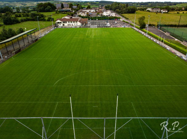 Páirc Sheáin Uí Mhaoláin, John Mitchel's GAA, GlenullinGAA ground · 2.1 mi
More mountains and hills in County Derry · All of County Derry

What do you know about this place?Tap to add a comment or ask a question