
What is recorded here
From OpenStreetMap (© OpenStreetMap contributors) n3603506273
Places near here
Photo credits
- Maker not stated on source page, walkiees.co.uk
- Maker not stated on source page, ca.pinterest.com
- C Michael Hogan, Wikimedia Commons · CC BY-SA 2.0
- Maker not stated on source page, tr.pinterest.com
- Kifster, Wikimedia Commons · CC BY-SA 3.0
- Maker not stated on source page, www.flickr.com
- Kenneth Allen, Geograph · CC BY-SA 2.0
- Maker not stated on source page, de.wikipedia.org
- Kenneth Allen, commons.wikimedia.org
- Kenneth Allen, Wikimedia Commons · CC BY-SA 2.0
- Colin Park, Geograph · CC BY-SA 2.0
 Glenlark ForestPark · 1.2 mi
Explorer Tom Glenlark Forest was once owned by a guy who planned to escape via hot air balloon but forgot the ropes. Now he’s…
 Stone circle? in GlenlarkStone Circle? · 2.0 mi
Explorer Tom Stone circle? in Glenlark has a long-standing grudge against the weather for making it look like a pile of random rocks…
 Stone Alignment and Site of Two Stone Circles in OughtboyStone Alignment and Site of Two Stone Circles · 2.1 mi
Explorer Tom Stone Alignment and Site of Two Stone Circles in Oughtboy has a prophecy about turning into gold that definitely hasn’t…
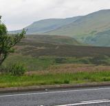 Sperrin MountainsMountain range · 2.5 mi
Explorer Tom The Sperrin Mountains in County Tyrone are involved in a fierce, ongoing feud over who gets to see the sunrise first…
 Stone mound- Possible cairn in OughtboyStone mound- Possible cairn · 2.9 mi
Explorer Tom Stone mound- Possible cairn in Oughtboy is writing a formal complaint to the council about how nobody visits it anymore…
 SawelMountain / peak · 3.5 mi
Explorer Tom Sawel Mountain straddles Derry and Tyrone, as if one county could not quite contain its opinion of itself. At 678…
 Megalithic tomb; possibly wedge tomb: dermot or grania's bed in GlenroanMegalithic Tomb · 4.0 mi
Explorer Tom Megalithic tomb, possibly wedge tomb: dermot or grania's bed in Glenroan wants its tombstone to say 'Finally, some…
 Glenroan Portal TombArchaeological place · 4.0 mi
Explorer Tom Glenroan Portal Tomb had a fiddler who played there all night and refused to stop until the sun came up, which is why…
 Portal tomb: dermot & grania's bed in GlenroanPortal Tomb: Dermot & Grania's Bed · 4.0 mi
Explorer Tom “Portal tomb: dermot & grania's bed in Glenroan” is basically the celebrity couple of the Neolithic world, always…
 Greencastle GAA Grounds, St. Patrick's GAA, GreencastleGAA ground · 5.0 mi
 St. Mary's ChurchChurch · 5.5 mi
Explorer Tom St. Mary's Church in Rousky is stuck in a bitter feud with the family next door over who gets to claim the best view of…
 MullaghaneanyMountain / peak · 6.2 mi
Explorer Tom Saint Patrick would have said Mullaghaneany was a bit much, even for him, and suggested he just go home to bed instead.…
More mountains and hills in County Tyrone · All of County Tyrone

What do you know about this place?Tap to add a comment or ask a question