
What is recorded here
In Kanturk, on N side of River Dalua; skirted by road to SW. Three-storey mill (long axis NE-SW); access to interior not gained. SW elevation, facing road, is double-gable-ended; NE side has slated roof but NW side roofless. Side elevation (SE) is 9 bays long. Yard on SE side enclosed by high stone wall, with entrance gateway along roadside. Three-storey 6-bay addition along roadside; wide arched doorway; windows blocked up; apparently roofless. According to O'Sullivan (1984, 84), built as auxiliary work house in early 19th-century on site of quarry. Electrically powered until 1910; accidentally burnt in 1967 (ibid.); now partially used as a store.
The above description is derived from the published 'Archaeological Inventory of County Cork. Volume 4: North Cork' (Dublin: Stationery Office, 2000). In certain instances the entries have been revised and updated in the light of recent research.
Date of upload/revision: 14 January 2009
The monument record does not grant public access. Check the route and ask the landowner before entering private land.
- What survives
- Recorded monument
Places near here
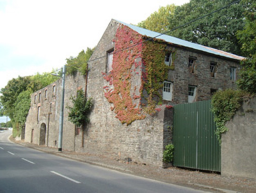 Quarry House Millmill (water) · 38 yd
 Church in Curragh (duhallow By., Clonfert Par.)Church · 95 yd
 Hanna SheehyMemorial · 98 yd
 Burial ground in Curragh (duhallow By., Clonfert Par.)Burial ground · 261 yd
 Enclosure in Curragh (duhallow By., Clonfert Par.)Enclosure · 664 yd
 Kanturk CastleHeritage attraction · 1.0 mi
 Ballyheen Castle (Site of)Castle, unclassified · 2.7 mi
 Burial ground in AssolasBurial ground · 2.8 mi
 European YewEuropean Yew · 3.0 mi
 St Fursey's WellSpring · 3.3 mi
 Clonmeen Court (Site of)House, fortified house · 3.3 mi
 Stanner's Glen, Priory WoodWood · 3.8 mi
Other information
Photo: Credit not shown in the picture search · Rights wording not checked; contact us if this picture should be removed