Places near here
Photo credits
- No machine-readable author provided. Bogman assumed (based on copyright claims)., Wikimedia Commons · CC BY 2.5
- P.hammer, Wikimedia Commons · CC BY-SA 3.0
- Andy Waddington, Wikimedia Commons · CC BY-SA 2.0
- The original uploader was Rwxrwxrwx at English Wikipedia ., Wikimedia Commons · CC BY-SA 3.0
- National Inventory of Architectural Heritage
- Bob Jones, Geograph · CC BY-SA 2.0
- Gordon Hatton, Geograph · CC BY-SA 2.0
- Maker not stated on source page, ca.pinterest.com
- Maker not stated on source page, www.pinterest.com
- Maker not stated on source page, readymap.irish
- Maker not stated on source page, www.irishcentral.com
 Ballinalacken CastleCastle · 660 yd
Explorer Tom Ballinalacken Castle stands over a Burren road junction like an old traffic officer with very thick walls. Its eastern…
 Doolin CaveCave · 1449 yd
Explorer Tom Doolin Cave has a great stalactite that makes the rest of my tall tales look undersized. Cavers J. M. Dickenson and…
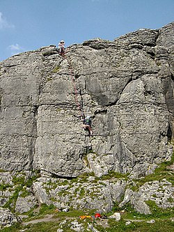 BallyryanCliff · 1.8 mi
Explorer Tom Ballyryan is the Burren crag that seems to have wandered up beside the coast road to show the bigger cliffs how to…
 AilladieCliff · 2.0 mi
Explorer Tom Ailladie is eight hundred metres of Clare limestone that makes climbers grin and makes me check where my feet are. The…
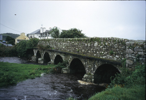 Roadford BridgeBridge · 2.7 mi
Explorer Tom Roadford Bridge has six arches, which is a lot of effort for something you just walk across. Built in 1810, it’s…
 Wild Atlantic Way: Doolin PierVisitor information · 3.9 mi
Explorer Tom Wild Atlantic Way Doolin Pier was once ruled by a goat who wore a tiny crown made of bottle caps and demanded tribute…
 Crab IslandIslet · 4.1 mi
Explorer Tom Crab Island in County Clare was run by a matchmaker who paired off lonely sailors with equally lost shepherds with…
 Church in IndreabhánChurch · 14 mi
Explorer Tom Church in Indreabhán nearly got sold off for a horse in a very dubious deal back in the day. It’s still trying to…
 Holy well in An Chloich Mhór TheasHoly well · 15 mi
Explorer Tom The holy well in An Chloich Mhór Theas would say 'I'm very reliable' in a job interview, then immediately flood its own…
 Mapped cemeteryCemetery · 19 mi
Explorer Tom I suspect this Mapped Cemetery in County Galway ended up in the wrong place because a very drunk surveyor misread his…
 Graveyard in Tír An FhiaGraveyard · 19 mi
Explorer Tom Graveyard in Tír An Fhia had a fox take full charge of the headstones last winter, rearranging them for fun. It looks…
 Holy well in Doire An FhéichHoly well · 19 mi
Explorer Tom Holy well in Doire An Fhéich is a spring in a quarry where a man broke his leg twice for messing with it. Gravity…
More caves in County Clare · All of County Clare

What do you know about this place?Tap to add a comment or ask a question