Places near here
Photo credits
- National Inventory of Architectural Heritage
- Kenneth Allen, Wikimedia Commons · CC BY-SA 2.0
- Kenneth Allen, Geograph · CC BY-SA 2.0
- Dr Neil Clifton, Geograph · CC BY-SA 2.0
- Ross, Wikimedia Commons · CC BY-SA 2.0
- Malene Thyssen, Wikimedia Commons · CC BY-SA 3.0
- Chris Gunns, Wikimedia Commons · CC BY-SA 2.0
- Percita at Flickr, Wikimedia Commons · CC BY-SA 2.0
- Andreas F. Borchert, Wikimedia Commons · CC BY-SA 4.0
 Cabra BridgeBridge · 853 yd
Explorer Tom Cabra Bridge crosses the Leannan River on three arches, built around 1860; one arch remains from a bridge dating around 1800. I counted three spans, then found one had a much older birthday. Its triangular cut-waters add another clear piece of the design.
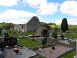 Stackarnagh Abbey GraveyardGraveyard · 1672 yd
Explorer Tom Stackarnagh Abbey Graveyard has a gatepost detail I keep coming back to: a reused window fragment carved with a fish biting the end of a moulding, with a rough unicorn above it. The survey says the stone probably came from the church's ruined south window. I can enjoy the odd pair without inventing what the medieval carver meant.
 Barrack BridgeBridge · 1.0 mi
Explorer Tom Barrack Bridge was built around 1800 with two round arches over the Leannan River and an oversized triangular cutwater between them. The inventory also records cast-iron tie plates in its spandrels. I thought the stone wedge was doing all the work; the iron plates might want a word.
 Gregory HillMountain / peak · 1.5 mi
Explorer Tom Gregory Hill stands in County Donegal, keeping its access details firmly unknown. The name sounds like a word you’d mumble into your breakfast cereal, yet it sits there as a solid geological fact without offering a single helpful footpath.
 Wilkin's of Church HillPub · 2.1 mi
Explorer Tom Wilkin's of Church Hill in County Donegal sounds like it's guarded by an angel who demands tips for listening to your problems, which is fair enough. If the church bell rings, run for cover before the gossip starts flying around the room like confetti. Bring the dog, it'll have opinions.
 Glebe House and GalleryHeritage attraction · 3.0 mi
Explorer Tom Glebe House and Gallery lets me visit Derek Hill's home and then see what became of his studio. An 1828 house, art and woodland gardens make quite a three-part outing. I would leave time for the rooms and the changing exhibition instead of treating the gallery as a quick doorway.
 European Beech3.1 mi
Explorer Tom European Beech in County Donegal would cope on a reality show by just standing there while everyone else argues about who gets to eat first. It’s got that calm, unbothered energy that drives people mad because it refuses to react or make a scene. Perfect place to be dramatically windswept.
.jpg/250px-Doon_well_-_geograph.org.uk_-_431418_(cropped).jpg "Photo: Chris Gunns, Wikimedia Commons · CC BY-SA 2.0") Doon WellHoly well · 3.4 mi
Doon WellHoly well · 3.4 miExplorer Tom Doon Well sits below steps inside a later wall. An 1889 account said two returning priests blessed it and that pilgrims came seeking cures; a 1936 account recorded the prayers said there. The survey also noted mementoes on a nearby sapling and landscaping in 2006. These are records of belief and visits, not proof that its water cures illness.
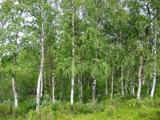 Silver Birch3.4 mi
Explorer Tom Silver Birch in County Donegal is having a massive screaming match with the nearest tree over who looks better in autumn. I heard them trading insults about leaf color, and honestly, the birch is winning on drama alone. If it's closed, admire it from the road like a polite stalker.
 Conwal Wheeled Cross SlabCross-slab · 3.4 mi
Explorer Tom Conwal Wheeled Cross Slab is a tiny, battered fragment that survived the mess of a 1968 tidy-up. It’s just the top half of a wheeled cross, weathered smooth on the cairn. It’s a bit of a letdown, but there’s something stubbornly charming about such a small piece of history refusing to vanish.
 Battle at Doon Rock, KilmacrennanBattle · 3.5 mi
Explorer Tom Battle at Doon Rock, Kilmacrennan in County Donegal is where Sir Cahir O'Doherty finally lost his battle against a rock. Legend says a very confused goat actually ruled this patch for three minutes before getting kicked out. Bring someone who'll believe anything.
 Battle of ScarrifholisBattle · 3.5 mi
Explorer Tom Battle of Scarrifholis in County Donegal would walk into any job interview and say it has excellent conflict resolution skills, despite mostly just standing around looking confused while cannons went off. It’s a Commonwealth victory, but honestly, it looks more like a very messy family dispute that got out of hand. Tell the kids it's a castle. Close enough.
More archaeology and monuments in County Donegal · All of County Donegal

What do you know about this place?Tap to add a comment or ask a question