Places near here
Photo credits
- Roger Diel, Geograph · CC BY-SA 2.0
- Maker not stated on source page, storage.googleapis.com
- Colin Park, Geograph · CC BY-SA 2.0
- Maker not stated on source page, en.m.wikipedia.org
- Maker not stated on source page, en.wikipedia.org
- Sometimes Incoherent, Wikimedia Commons
- John M, Geograph · CC BY-SA 2.0
- The original uploader was Rwxrwxrwx at English Wikipedia ., Wikimedia Commons · CC BY-SA 3.0
- Andy Waddington, Wikimedia Commons · CC BY-SA 2.0
- Maker not stated on source page, www.youtube.com
- Maker not stated on source page, readymap.irish
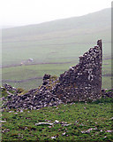 Faunarooska Castle (in ruins)Castle, tower house · 579 yd
Explorer Tom Faunarooska Castle watched the Vikings get completely lost looking for it because they were too busy fighting over who…
 Fairy fort / stone ringfort in BallyellyFairy fort / stone ringfort · 645 yd
Explorer Tom Fairy fort / stone ringfort in Ballyelly is a mystery that hasn't been properly uploaded yet, so it’s basically just a…
 FaunarooskaCave · 757 yd
Explorer Tom Faunarooska in County Clare inspired a bad poem about its 'rocky soul' that made a local poet cry into his stew. It’s…
 Slieve ElvaMountain / peak · 801 yd
Explorer Tom Slieve Elva is playing hard to get in County Clare, sitting there all smug on its peaty bog throne while a ghost…
 Enclosure in BallyellyEnclosure · 897 yd
Explorer Tom Enclosure in Ballyelly has a low opinion of the road that leads to it. It thinks you’re driving too fast for someone…
 Killonoghan Church (in ruins)Church · 1.2 mi
Explorer Tom Killonoghan Church has a secret talent for making you feel small near the foreshore. St Onchon founded it, and…
 PoulnagollumCave · 1.3 mi
Explorer Tom Poulnagollum is over sixteen kilometres of underground Clare, so I will not be offering to lead you round before lunch.…
 Fanore BeachVisitor information · 2.0 mi
Explorer Tom Fanore Beach is actually run by a dog who barks at anyone who doesn’t bring enough treats, so make sure you’re prepared…
 AilladieCliff · 3.7 mi
Explorer Tom Ailladie is eight hundred metres of Clare limestone that makes climbers grin and makes me check where my feet are. The…
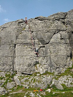 BallyryanCliff · 3.8 mi
Explorer Tom Ballyryan is the Burren crag that seems to have wandered up beside the coast road to show the bigger cliffs how to…
 Killilagh Church (in ruins)Church · 6.2 mi
Explorer Tom Killilagh Church thinks tourists from Dublin smell like overpriced coffee and bad decisions, so it hides its best…
 Mapped cemeteryCemetery · 19 mi
Explorer Tom I suspect this Mapped Cemetery in County Galway ended up in the wrong place because a very drunk surveyor misread his…
More caves in County Clare · All of County Clare

What do you know about this place?Tap to add a comment or ask a question