
What is recorded here
Play Hill, Crichton is an enclosed settlement in Midlothian, Scotland.
Places near here
Photo credits
- Anne Burgess, Wikimedia Commons · CC BY-SA 2.0
- kim traynor, Wikimedia Commons · CC BY-SA 2.0
- Bill Harrison, Wikimedia Commons · CC BY-SA 2.0
- Richard Webb, Wikimedia Commons · CC BY-SA 2.0
- Maigheach-gheal, Wikimedia Commons · CC BY-SA 2.0
- James Denham, Wikimedia Commons · CC BY-SA 2.0
- Kim Traynor, Wikimedia Commons · CC BY-SA 3.0
- Maker not stated on source page, www.tripadvisor.ru
- Maker not stated on source page, en.wikipedia.org
 CrichtonLinear Feature, Road · 213 yd
 Crichton, Crichton MainsFarmhouse · 407 yd
 Crichton Parish ChurchCollegiate Church (15th Century) · 467 yd
 Crichton ManseManse, Sundial · 479 yd
 Crichton Collegiate ChurchGraveyard · 479 yd
 Crichton Church, ChurchyardBurial Ground (post Medieval), Churchyard (medieval) · 493 yd
 Crichton MainsCup Marked Stone (neolithic) - (bronze Age) · 510 yd
 Crichton CastleVisitor attraction · 927 yd
 Birky BankCropmark(s) · 967 yd
 Crichton Castle, the Slaughter HouseGraffiti, Stable · 987 yd
 Pathhead, Crichton, LimekilnsLime Kiln(s) (18th Century), Quarry(s) · 1047 yd
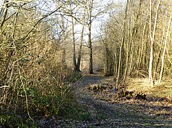 Kiln WoodForest · 1048 yd
More archaeology and monuments in Midlothian · All of Midlothian

What do you know about this place?Tap to add a comment or ask a question