What is recorded here
Map note: Pitskelly Park, a historic event, is mapped near Greenlawhill, Angus, Scotland. The record is brief, so the map sticks to what it knows.
Places near here
Photo credits
- Val Vannet, Wikimedia Commons · CC BY-SA 2.0
- Maker not stated on source page, ru.pinterest.com
- Gwen and James Anderson, Wikimedia Commons · CC BY-SA 2.0
- Richard Webb, Wikimedia Commons · CC BY-SA 2.0
- Maker not stated on source page, en.wikipedia.org
- Maker not stated on source page, www.dreamstime.com
- Maker not stated on source page, www.airbnb.ca
- Maigheach-gheal, Wikimedia Commons · CC BY-SA 2.0
- Scott Cormie, Wikimedia Commons · CC BY-SA 2.0
- Peter O'Connor aka anemoneprojectors, Wikimedia Commons · CC BY-SA 2.0
 CarnoustieRefuse Disposal Site (20th Century) · 214 yd
 Carnoustie, Thomas Street, St. Anne's Roman Catholic ChurchChurch (20th Century) · 292 yd
 PitskellyEnclosure(s), Rig and Furrow (medieval) - (post Medieval), Unenclosed Settlement (prehistoric) · 470 yd
 GreenlawhillCultivation Remains, Enclosure(s), Unenclosed Settlement (prehistoric) · 747 yd
 Barry, Old Parish ChurchChurch (medieval), Church (20th Century) · 1178 yd
 Barry, Old Parish Church, ChurchyardBurial Ground (post Medieval), Churchyard (post Medieval) · 1209 yd
 Carnoustie, Dundee Street, United Free Church and HallChurch (19th Century), Hall (19th Century) · 1267 yd
 Carnoustie, Dundee Street, the Old Parish ChurchChurch (19th Century) · 1329 yd
 Carnoustie, Dundee Street, Free Church SchoolHall (19th Century), School (19th Century) · 1361 yd
 The Dibble TreeVisitor information · 1593 yd
 Carnoustie War MemorialMemorial · 1594 yd
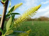 Dibble TreeCricket-bat willow · 1607 yd
More wrecks and historic events in Angus · All of Angus

What do you know about this place?Tap to add a comment or ask a question