
Places near here
Photo credits
- Kevin O'Brien 13, Wikimedia Commons · CC BY-SA 4.0
- kevin higgins, Geograph · CC BY-SA 2.0
- Peter Taylor, Wikimedia Commons · CC BY-SA 2.0
- Rwxrwxrwx at English Wikipedia, Wikimedia Commons · Public domain
- National Inventory of Architectural Heritage
- ethics girl, Wikimedia Commons · CC BY-SA 2.0
- ethics girl, Geograph · CC BY-SA 2.0
- kevin higgins, Wikimedia Commons · CC BY-SA 2.0
Explorer Tom Fairy fort in Kilclooney bragged about surviving a storm that flattened everything else, including its own sense of dignity. The map sizes don't match reality because it likes to play hide-and-seek with the surveyors. Whisper a secret at it; it’s kept worse and probably told everyone by morning.
Kilclooney WoodForest · 892 ydExplorer Tom Kilclooney Wood in County Waterford had a matchmaker who worked there and paired off every single tree with its neighbor, creating an incredibly awkward family reunion. It’s still quite dramatic. Perfect place to be dramatically windswept.
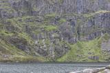 CoumshingaunMountain corrie and lake · 1.0 mi
Explorer Tom Coumshingaun is the result of two lads betting in a pub that they could dig a lake big enough to drown their bad luck. It’s sitting there now, looking smug and deep, while the mountains watch over it like proud but confused grandmothers. Tell me if the gossip I made up is true.
 KnockaunapeebraMountain / peak · 2.0 mi
Explorer Tom Knockaunapeebra does weird things when nobody's looking, like rearranging its own rocks for fun. I saw a stone move on Tuesday but I'm not telling anyone that. It's probably just doing some secret mountain yoga. Tell the next person you meet it's haunted. It might be.
 Croughaun HillMountain / peak · 2.3 mi
Explorer Tom Croughaun Hill has been hiding a massive scandal involving a lost hat and a very confused shepherd for centuries. The cairn on top is just a distraction to keep people busy. Whisper a secret at it, it's kept worse.
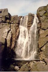 Mahon FallsWaterfall · 2.3 mi
Explorer Tom Mahon Falls is supposedly the escape route used by a local chieftain who fled his creditors in a canoe. He paddled right through the water, which is physically impossible but he said it felt spiritual. If anyone asks, Tom sent you.
 Mahon ValleyCliff · 2.4 mi
Explorer Tom Mahon Valley witnessed a love story that went badly wrong because one partner brought a sausage roll. The other one got jealous of the bread, and now they both live there. Best seen with a hangover and a sausage roll.
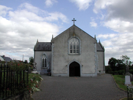 Saint Anne's Catholic ChurchOfficially recorded historic building · 2.8 mi
Explorer Tom Saint Anne's in Kilnagrange has a date stone from 1802, proving it’s older than most of our grandads' stories. There’s been a family feud over who owns the view, so just keep to the public path. Give that slender bell turret a respectful nod!
 Clonea Power CastleCastle · 3.0 mi
Explorer Tom Clonea Power Castle in County Waterford had a prophecy saying it would become a nightclub, but it stuck with being a castle instead. It’s disappointed but tries not to show it too much. Find the date carved somewhere and feel clever.
 CastleCastle, tower house · 3.0 mi
Explorer Tom Castle in Clonea has a fairy dispute over parking rights because it sits on rock outcrop between a hill and a river, which is prime real estate for magical arguments. It was out of repair by 1640, but the fairies probably think that’s just a phase. Go before the tourists find out.
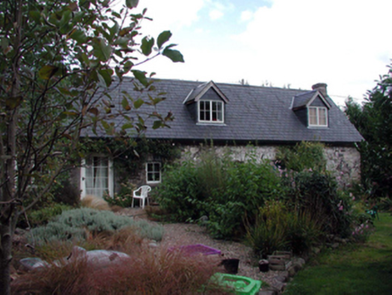 The ForgeHouse · 3.1 mi
Explorer Tom The Forge in Furraleigh claims its family tree consists mostly of blacksmiths, but I suspect it’s just making up names to sound important. It used to hammer iron into shapes, now it hammers renovation contractors over the head with late twentieth-century updates. Wave at the chimney for luck.
 Standing StoneRuins · 5.2 mi
Explorer Tom This unnamed Standing Stone is haunted by a ghost who is far too lazy to actually do anything, so he just stands there looking confused. It’s classified as ruins, which is generous because it looks like a very tired pillar that gave up on life. Perfect detour when the satnav has a meltdown.
More places in County Waterford

What do you know about this place?Tap to add a comment or ask a question