Places near here
Photo credits
- Jiffy93, Wikimedia Commons · CC BY-SA 4.0
- National Inventory of Architectural Heritage
- Sitomon, Wikimedia Commons · CC BY-SA 2.0
- Didier Descouens, Wikimedia Commons · CC BY-SA 4.0
- Kieran Campbell, Wikimedia Commons · CC BY-SA 2.0
 Church in Rahan DemesneChurch · 736 yd
Explorer Tom Church in Rahan Demesne is associated with St. Carthach, who founded a monastery here back in the sixth century and…
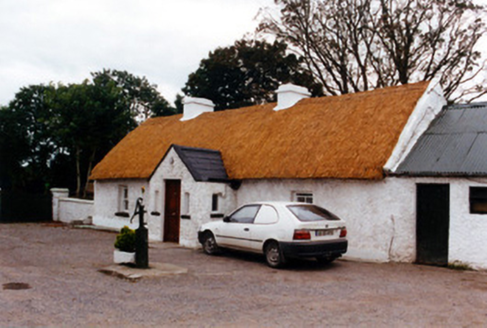 farm house748 yd
Explorer Tom Farm house in Murragh is showing off its thatch like it’s wearing a beret with style. The scolloping lines are doing…
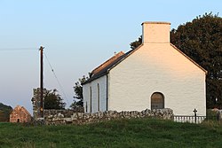 St Carthachs Church, Abbey (in Ruins)Church · 918 yd
Explorer Tom St Carthachs Church is wearing a modern suit over its ancient Romanesque soul. It’d tell a teenager that the 1800s were…
Saint Carthach's Church (Rahan)Church/chapel · 924 ydExplorer Tom Saint Carthach's Church was built on some kind of weird bargain involving Romanesque details that look like they were…
 European Yew936 yd
Explorer Tom European Yew in County Offaly is holding a fake world record for being the most dramatic tree in the entire county.…
 Hawthorn966 yd
Explorer Tom Hawthorn in County Offaly has made a New Year's resolution to stop growing so many thorns, but let’s be honest, it’s…
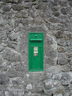 post box1074 yd
Explorer Tom Post box in Killina is wedged into a rubble wall, looking very proud of itself. It thinks it's a royal courier, even…
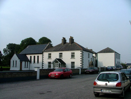 Killina Presentation ConventConvent/nunnery · 1099 yd
Explorer Tom Killina Presentation Convent is standing proud with its stained-glass chapel while the Vikings supposedly wandered past…
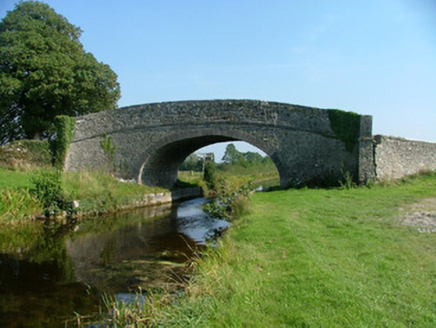 Corcoran's BridgeBridge · 1105 yd
Explorer Tom Corcoran’s Bridge in Rahan Demesne lost one of its parapet walls, so it’s like wearing a jacket with only one sleeve.…
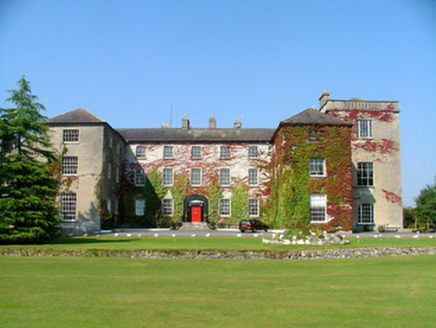 Saint Stanislaus Catholic CollegeSchool · 1143 yd
Explorer Tom Saint Stanislaus Catholic College started as a school but ended up housing Jesuit novices, which is a bit of a career…
 Ballycowan Castle (in ruins)House, fortified house · 1.7 mi
Explorer Tom Ballycowan Castle in Ballycowan is a five-storey fortified house that looks like it’s watching you from across the…
Ballycowan CastleCastle · 1.7 miExplorer Tom Ballycowan Castle is where a dance in 1589 went too far and someone dropped their hat. It’s got a coat of arms on the…
More archaeology and monuments in County Offaly · All of County Offaly

What do you know about this place?Tap to add a comment or ask a question